MyTopo
Howth Texas US Topo Map
Couldn't load pickup availability
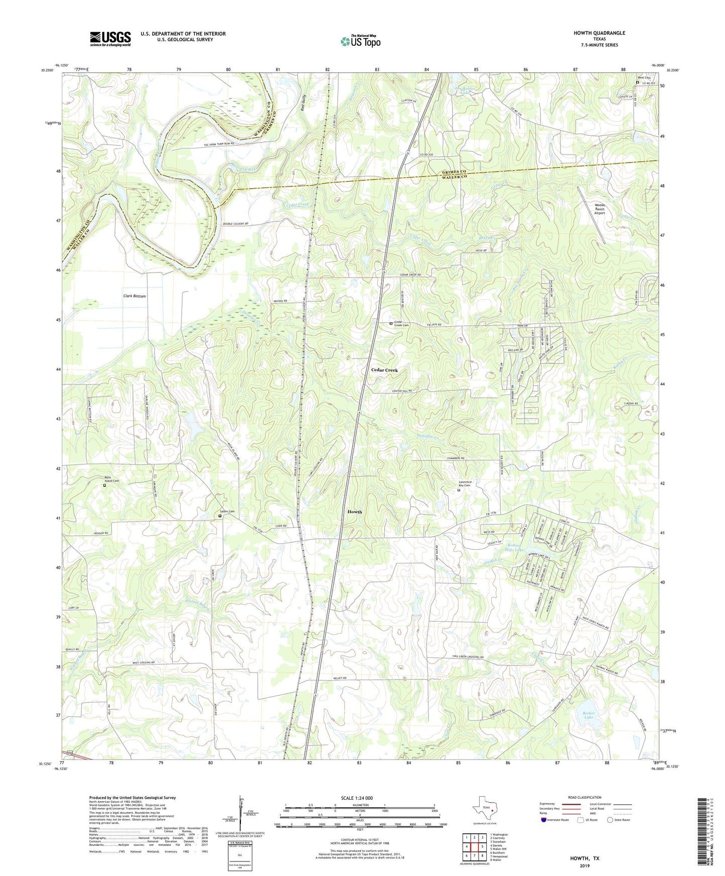
2022 topographic map quadrangle Howth in the state of Texas. Scale: 1:24000. Based on the newly updated USGS 7.5' US Topo map series, this map is in the following counties: Waller, Grimes, Washington. The map contains contour data, water features, and other items you are used to seeing on USGS maps, but also has updated roads and other features. This is the next generation of topographic maps. Printed on high-quality waterproof paper with UV fade-resistant inks.
Quads adjacent to this one:
West: Daniels
Northwest: Washington
North: Courtney
Northeast: Stoneham
East: Waller NW
Southeast: Waller
South: Hempstead
Southwest: Buckhorn
This map covers the same area as the classic USGS quad with code o30096b1.
Contains the following named places: Beason Creek, Becker Lake, Becker Lake Dam, Big Sandy Creek, Brown College, Cedar Creek, Cedar Creek Cemetery, Center Hill Church, Clark Bottom, Gladish Creek, Howth, Lawrence Key, Lawrence Key Cemetery, Los Robles Lake, Red Gully, Rock Island Cemetery, Rock Island Church, Rocky Creek, Rolling Hills, Rolling Hills Dam, Rolling Hills Lake, Saint Luke Church, Salem Cemetery, Second Corinth, Second Corinth Church, Weeski Ranch Airport, West Cemetery