MyTopo
Blanton Texas US Topo Map
Couldn't load pickup availability
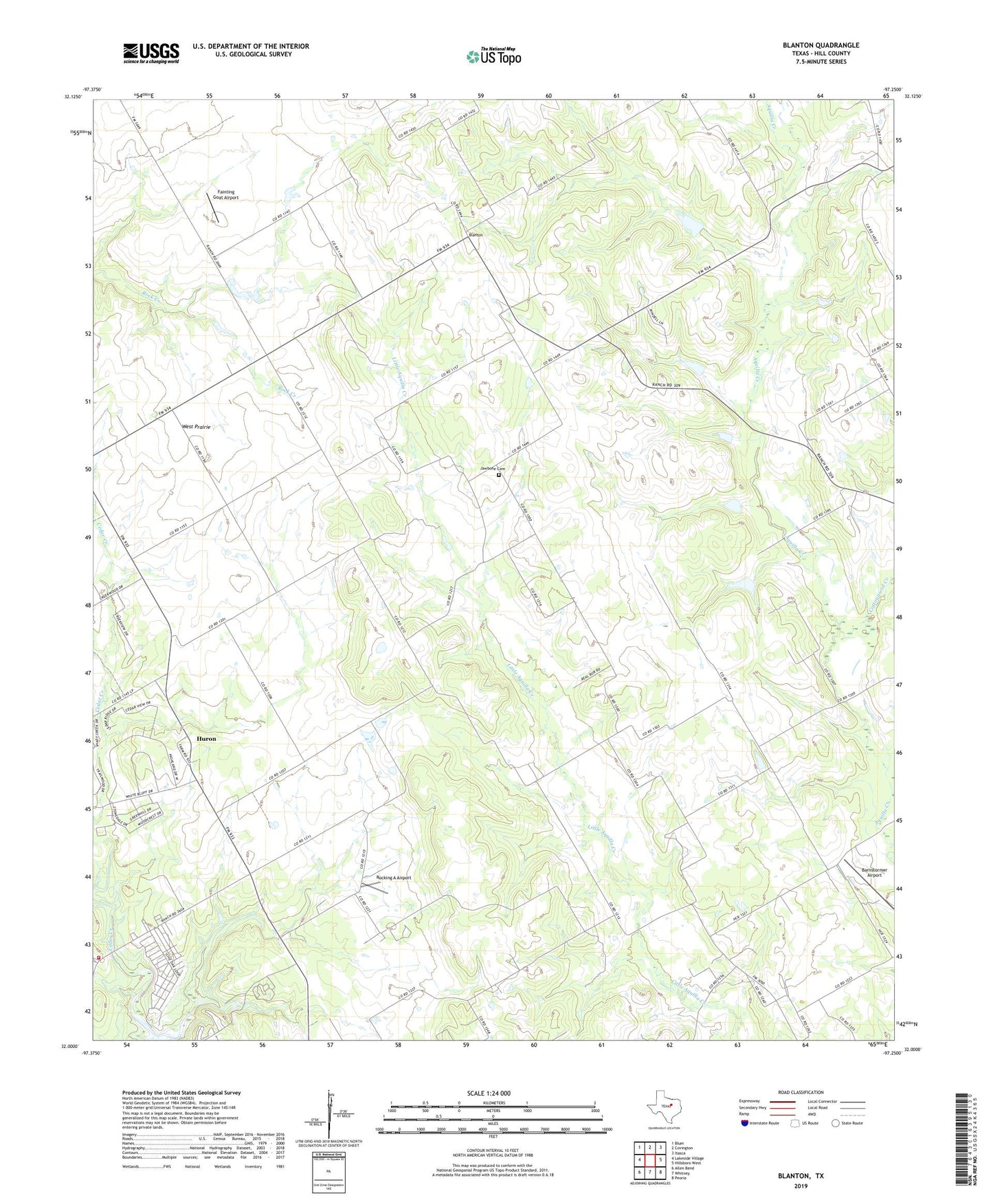
2022 topographic map quadrangle Blanton in the state of Texas. Scale: 1:24000. Based on the newly updated USGS 7.5' US Topo map series, this map is in the following counties: Hill. The map contains contour data, water features, and other items you are used to seeing on USGS maps, but also has updated roads and other features. This is the next generation of topographic maps. Printed on high-quality waterproof paper with UV fade-resistant inks.
Quads adjacent to this one:
West: Lakeside Village
Northwest: Blum
North: Covington
Northeast: Itasca
East: Hillsboro West
Southeast: Peoria
South: Whitney
Southwest: Allen Bend
This map covers the same area as the classic USGS quad with code o32097a3.
Contains the following named places: 2604 Volunteer Fire Department, Barnstormer Airport, Blanton, Cottonwood Creek, Fainting Goat Airport, Grub Hill, Huron, Jawbone Cemetery, Live Oak Resorts, Red Hill, Rocking A Airport, Shiloh Church, Soil Conservation Service Site 6 Dam, Soil Conservation Service Site 6 Reservoir, Soil Conservation Service Site 7 Dam, Soil Conservation Service Site 7 Reservoir, Soil Conservation Service Site 8 Dam, Soil Conservation Service Site 8 Reservoir, Soil Conservation Service Site 9 Dam, Soil Conservation Service Site 9 Reservoir, West Prairie