MyTopo
Crane Islands NW Texas US Topo Map
Couldn't load pickup availability
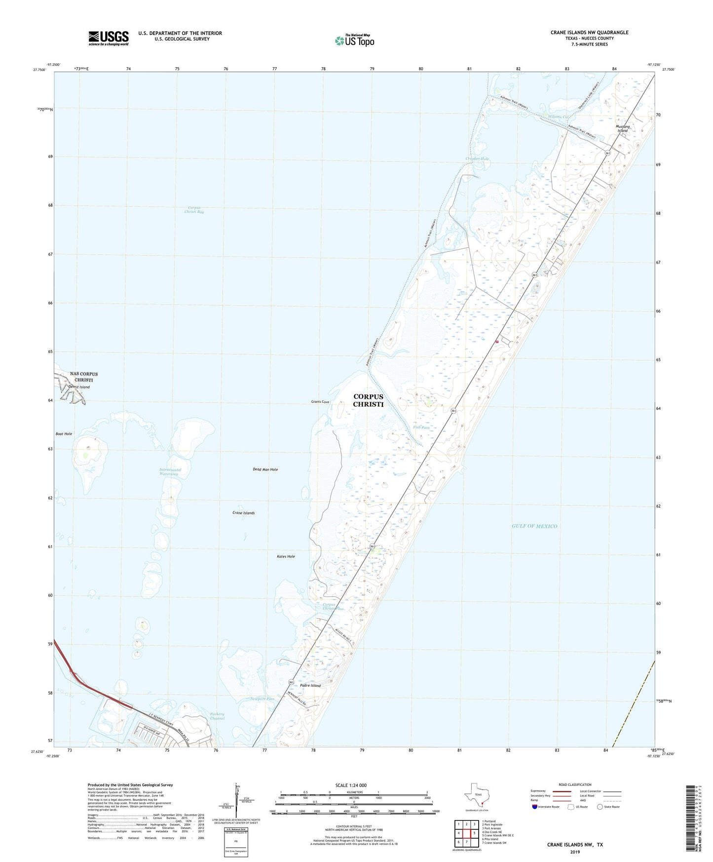
2025 topographic map quadrangle Crane Islands NW in the state of Texas. Scale: 1:24000. Based on the newly updated USGS 7.5' US Topo map series, this map is in the following counties: Nueces. The map contains contour data, water features, and other items you are used to seeing on USGS maps, but also has updated roads and other features. This is the next generation of topographic maps. Printed on high-quality waterproof paper with UV fade-resistant inks.
Quads adjacent to this one:
West: Oso Creek NE
Northwest: Portland
North: Port Ingleside
Northeast: Port Aransas
East: Crane Islands NW OE E
South: Crane Islands SW
Southwest: Pita Island
This map covers the same area as the classic USGS quad with code o27097f2.
Contains the following named places: Boat Hole, Corpus Christi Fire Department Station 16, Corpus Christi Pass, Crane Islands, Croaker Hole, Dead Man Hole, Demit Island, Fish Pass, Grants Cove, Kates Hole, Land and Sea Marina, Marker 37 Marina, Mustang Island, Mustang Island Heliport, Mustang Island State Park, Newport Pass, Packery Channel Park, Puenta Vista Marina, Range A Front Light, Smithville Public Library, The Coastway Marina, Wilsons Cut