MyTopo
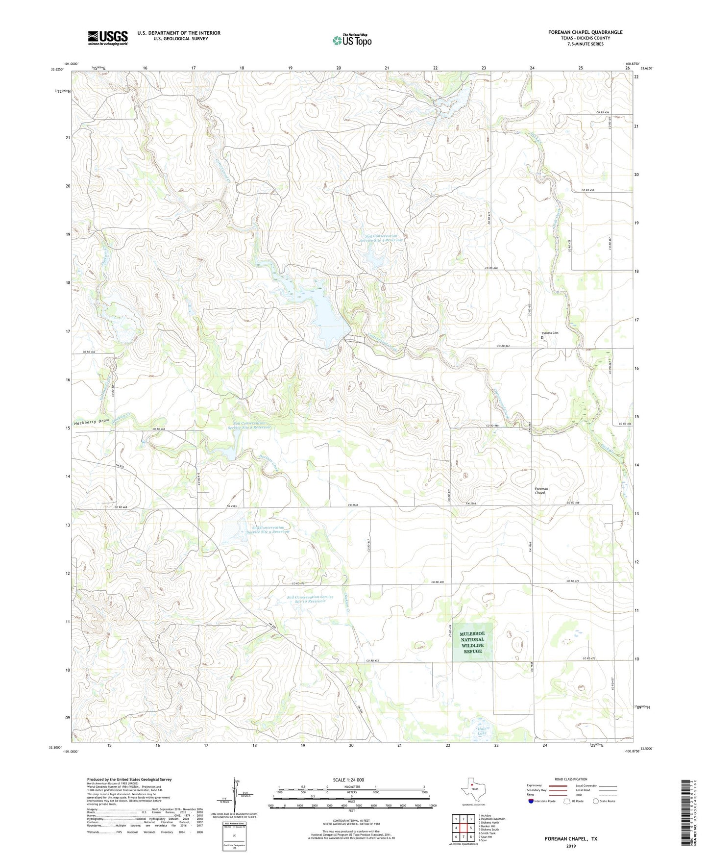
Foreman Chapel Texas US Topo Map
Couldn't load pickup availability
2022 topographic map quadrangle Foreman Chapel in the state of Texas. Scale: 1:24000. Based on the newly updated USGS 7.5' US Topo map series, this map is in the following counties: Dickens. The map contains contour data, water features, and other items you are used to seeing on USGS maps, but also has updated roads and other features. This is the next generation of topographic maps. Printed on high-quality waterproof paper with UV fade-resistant inks.
Quads adjacent to this one:
West: Bunker Hill
Northwest: McAdoo
North: Haystack Mountain
Northeast: Dickens North
East: Dickens South
Southeast: Spur
South: Spur NW
Southwest: Smith Tank
This map covers the same area as the classic USGS quad with code o33100e8.
Contains the following named places: Cottonwood Creek, Espuela Cemetery, Foreman Chapel, Hackberry Draw, Hale Lake, Hale Lake Dam, Soil Conservation Service Site 10 Dam, Soil Conservation Service Site 10 Reservoir, Soil Conservation Service Site 3 Dam, Soil Conservation Service Site 3 Reservoir, Soil Conservation Service Site 4 Dam, Soil Conservation Service Site 4 Reservoir, Soil Conservation Service Site 5 Dam, Soil Conservation Service Site 5 Reservoir, Soil Conservation Service Site 7 Dam, Soil Conservation Service Site 7 Reservoir, Soil Conservation Service Site 8 Dam, Soil Conservation Service Site 8 Reservoir, Soil Conservation Service Site 9 Dam, Soil Conservation Service Site 9 Reservoir, Spur Headquarters Ranch Dam, Spur Headquarters Ranch Lake, ZIP Code: 79370