MyTopo
Dressing Point Texas US Topo Map
Couldn't load pickup availability
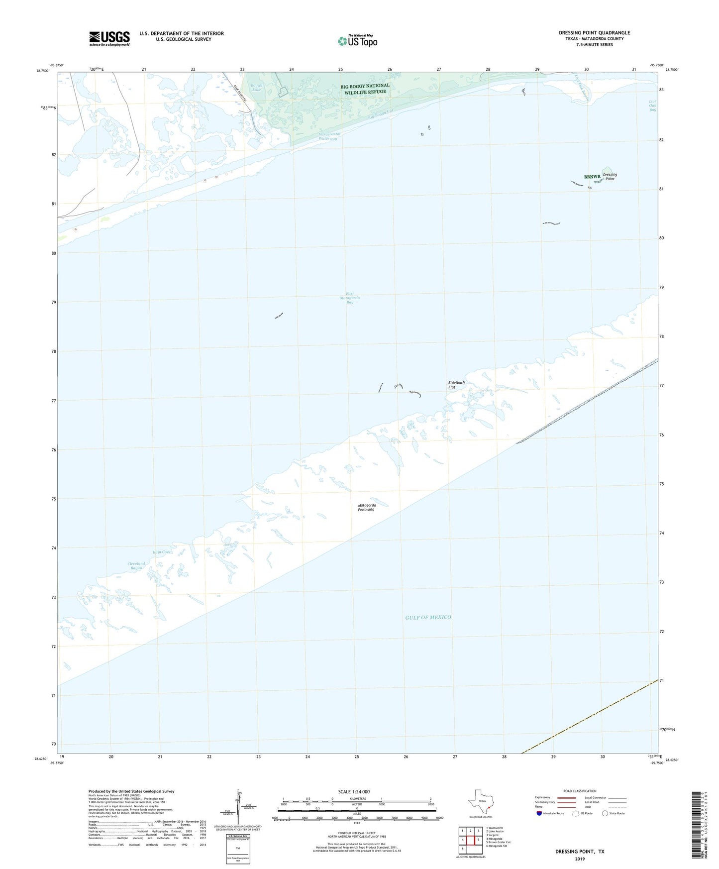
2025 topographic map quadrangle Dressing Point in the state of Texas. Scale: 1:24000. Based on the newly updated USGS 7.5' US Topo map series, this map is in the following counties: Matagorda. The map contains contour data, water features, and other items you are used to seeing on USGS maps, but also has updated roads and other features. This is the next generation of topographic maps. Printed on high-quality waterproof paper with UV fade-resistant inks.
Quads adjacent to this one:
West: Matagorda
Northwest: Wadsworth
North: Lake Austin
Northeast: Sargent
East: Brown Cedar Cut
Southwest: Matagorda SW
This map covers the same area as the classic USGS quad with code o28095f7.
Contains the following named places: Big Boggy Creek, Big Boggy Cut, Boggy Lake, Chinquapin Landing, Cleveland Bayou, Dressing Point, East Matagorda Bay, Eidelbach Flat, Kain Cove, Live Oak Bay, Live Oak Bayou, Matagorda Shore Facility Heliport, Oyster Farm Drain