MyTopo
Sargent Texas US Topo Map
Couldn't load pickup availability
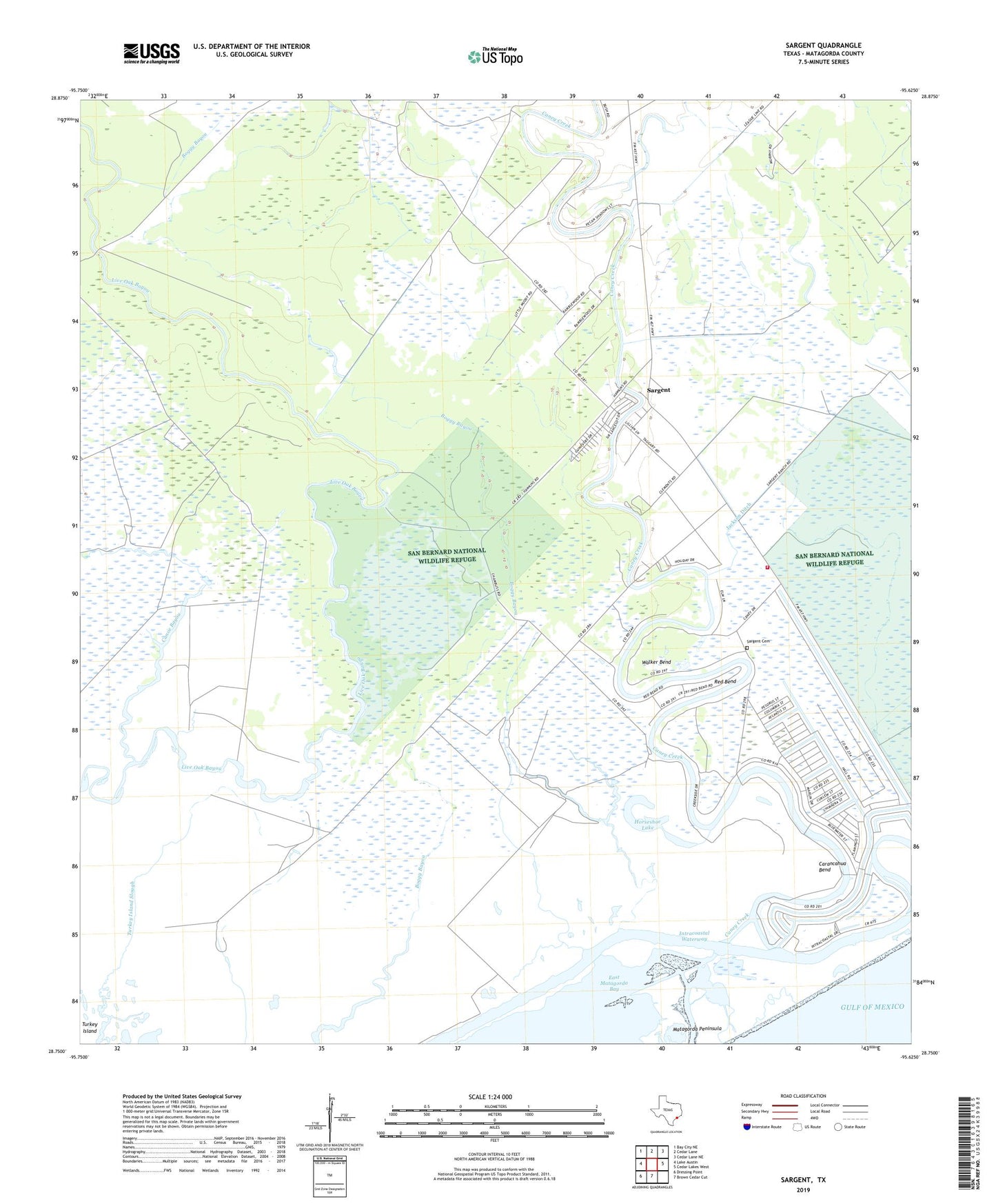
2025 topographic map quadrangle Sargent in the state of Texas. Scale: 1:24000. Based on the newly updated USGS 7.5' US Topo map series, this map is in the following counties: Matagorda. The map contains contour data, water features, and other items you are used to seeing on USGS maps, but also has updated roads and other features. This is the next generation of topographic maps. Printed on high-quality waterproof paper with UV fade-resistant inks.
Quads adjacent to this one:
West: Lake Austin
Northwest: Bay City NE
North: Cedar Lane
Northeast: Cedar Lane NE
East: Cedar Lakes West
South: Brown Cedar Cut
Southwest: Dressing Point
This map covers the same area as the classic USGS quad with code o28095g6.
Contains the following named places: Caney Creek, Caney Creek Marina, Canoe Bayou, Carancahua Bend, Cedar Lakes School, Dead Caney Lake, Horseshoe Lake, Jackson Ditch, Matagorda County Constable's Office Precinct 6, Red Bend, Sargent, Sargent Cemetery, Sargent Census Designated Place, Sargent Volunteer Fire and Rescue, Turkey Island, Walker Bend