MyTopo
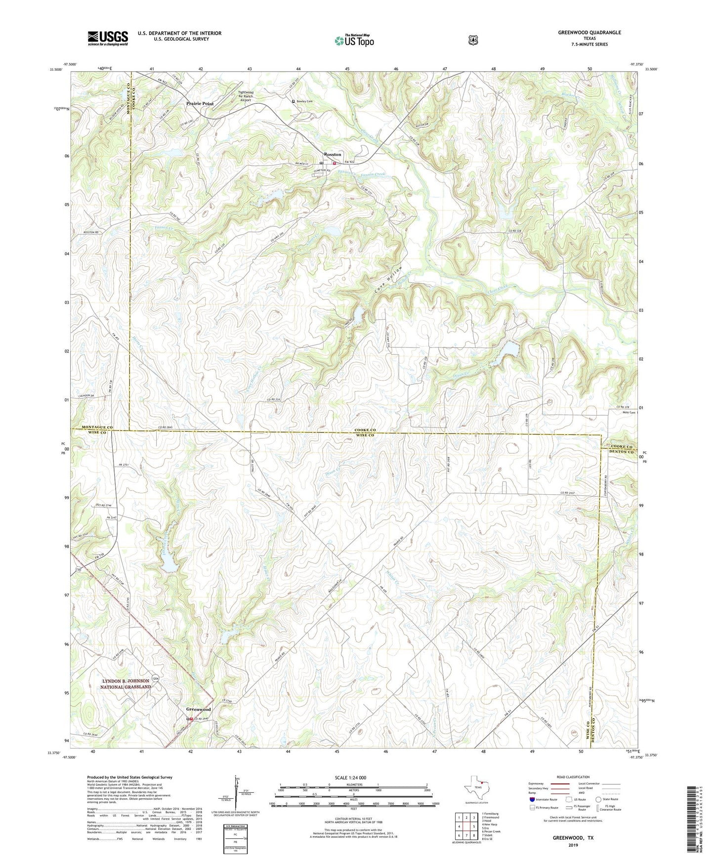
Greenwood Texas US Topo Map
Couldn't load pickup availability
Also explore the Greenwood Forest Service Topo of this same quad for updated USFS data
2022 topographic map quadrangle Greenwood in the state of Texas. Scale: 1:24000. Based on the newly updated USGS 7.5' US Topo map series, this map is in the following counties: Wise, Cooke, Montague, Denton. The map contains contour data, water features, and other items you are used to seeing on USGS maps, but also has updated roads and other features. This is the next generation of topographic maps. Printed on high-quality waterproof paper with UV fade-resistant inks.
Quads adjacent to this one:
West: New Harp
Northwest: Forestburg
North: Freemound
Northeast: Hood
East: Era
Southeast: Era SE
South: Slidell
Southwest: Pecan Creek
This map covers the same area as the classic USGS quad with code o33097d4.
Contains the following named places: Bewley Cemetery, Coons Creek, Cove Hollow, Cove Hollow Creek, Dixon Creek, Dixon Creek Church, Fannin Creek, Greenwood, Greenwood - Slidell Volunteer Fire Department Station 2, Greenwood Post Office, Leo, Miller Creek, Prairie Point, Rosston, Rosston Post Office, Rosston Volunteer Fire Department, Soil Conservation Service Site 17 Dam, Soil Conservation Service Site 17 Reservoir, Soil Conservation Service Site 17a Dam, Soil Conservation Service Site 17a Reservoir, Soil Conservation Service Site 21 Dam, Soil Conservation Service Site 21 Reservoir, Soil Conservation Service Site 31 Dam, Soil Conservation Service Site 31 Reservoir, Soil Conservation Service Site 32 Dam, Soil Conservation Service Site 32 Reservoir, Soil Conservation Service Site 33 Dam, Soil Conservation Service Site 33 Reservoir, Soil Conservation Service Site 34 Dam, Soil Conservation Service Site 34 Reservoir, Soil Conservation Service Site 35 Dam, Soil Conservation Service Site 35 Reservoir, Soil Conservation Service Site 36 Dam, Soil Conservation Service Site 36 Reservoir, Tightwaad Air Ranch Airport, Wheat Creek, Williams Creek, ZIP Code: 76263