MyTopo
Fencepost Draw Texas US Topo Map
Couldn't load pickup availability
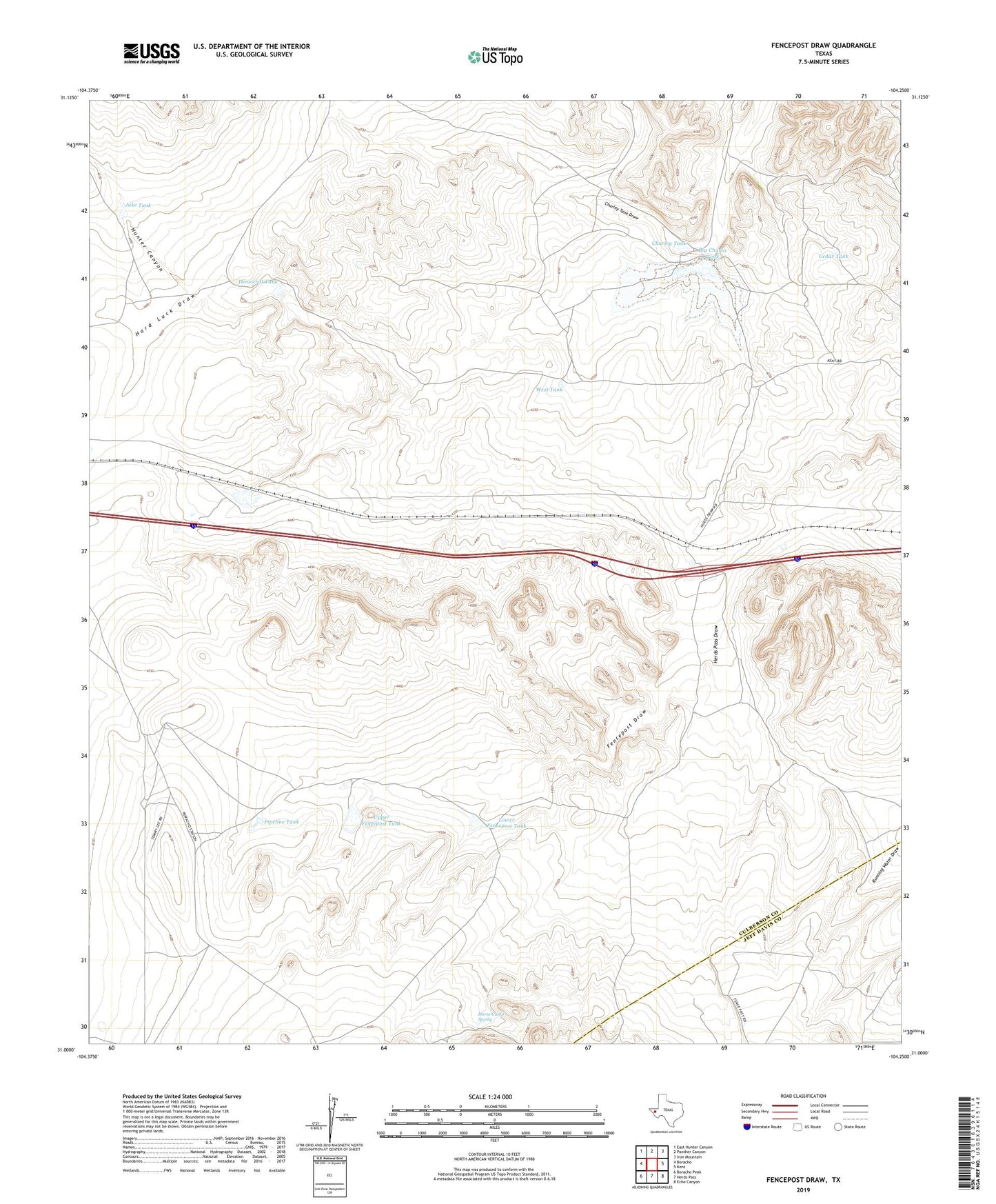
2022 topographic map quadrangle Fencepost Draw in the state of Texas. Scale: 1:24000. Based on the newly updated USGS 7.5' US Topo map series, this map is in the following counties: Culberson, Jeff Davis. The map contains contour data, water features, and other items you are used to seeing on USGS maps, but also has updated roads and other features. This is the next generation of topographic maps. Printed on high-quality waterproof paper with UV fade-resistant inks.
Quads adjacent to this one:
West: Boracho
Northwest: East Hunter Canyon
North: Panther Canyon
Northeast: Iron Mountain
East: Kent
Southeast: Echo Canyon
South: Herds Pass
Southwest: Boracho Peak
This map covers the same area as the classic USGS quad with code o31104a3.
Contains the following named places: Big Charley Tank, Cedar Tank, Charley Tank, Charley Tank Draw, Democrat Tank, Duncan Tank, Fencepost Draw, Gardner Camp, Hard Luck Draw, Horse Camp Spring, Hunter Canyon, Jake Tank, Lamb Pasture Tank, Lower Fencepost Tank, Middle Horse Camp Tank, New Thompson Tank, New Well Windmill, Pipeline Tank, Reynolds Cattle Company Dam, Upper Fencepost Tank, Water Tank, West Tank