MyTopo
Flake Texas US Topo Map
Couldn't load pickup availability
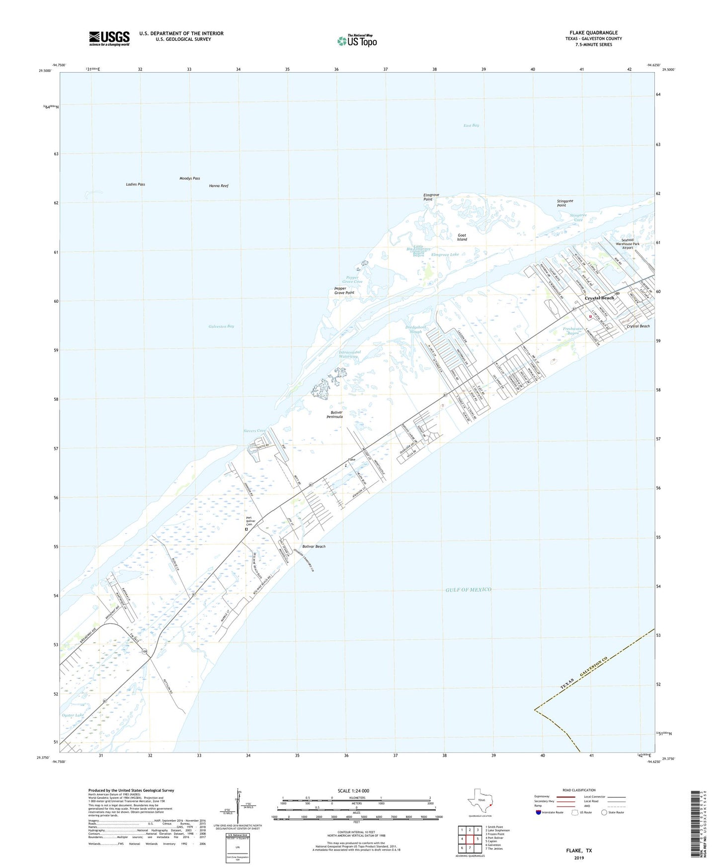
2025 topographic map quadrangle Flake in the state of Texas. Scale: 1:24000. Based on the newly updated USGS 7.5' US Topo map series, this map is in the following counties: Galveston. The map contains contour data, water features, and other items you are used to seeing on USGS maps, but also has updated roads and other features. This is the next generation of topographic maps. Printed on high-quality waterproof paper with UV fade-resistant inks.
Quads adjacent to this one:
West: Port Bolivar
Northwest: Smith Point
North: Lake Stephenson
Northeast: Frozen Point
East: Caplen
South: The Jetties
Southwest: Galveston
This map covers the same area as the classic USGS quad with code o29094d6.
Contains the following named places: Beacon Bayou, Big Elmgrove Bayou, Bolivar Beach, Bolivar Peninsula, Bolivar Peninsula Division, Bolivar Yacht Basin Marina, Coyle Slip, Crenshaw Elementary School and Middle School, Crystal Beach, Crystal Beach Post Office, Crystal Beach Volunteer Fire Department and Emergency Medical Services, Dredgeboat Slough, Elmgrove, Elmgrove Lake, Elmgrove Point, Flake, Freshwater Bayou, Galveston County Constable's Office Precinct 3, Goat Island, Johnson Bayou, KRTX-FM (Galveston), Ladies Pass, Little Elmgrove Bayou, Moodys Pass, Oyster Lake, Patton Woods, Pepper Grove Cove, Pepper Grove Point, Port Bolivar Cemetery, Seafood Warehouse Park Airport, Sievers Cove, Stingaree, Stingaree Cove, Stingaree Point, ZIP Code: 77650