MyTopo
Flatrock Crossing Texas US Topo Map
Couldn't load pickup availability
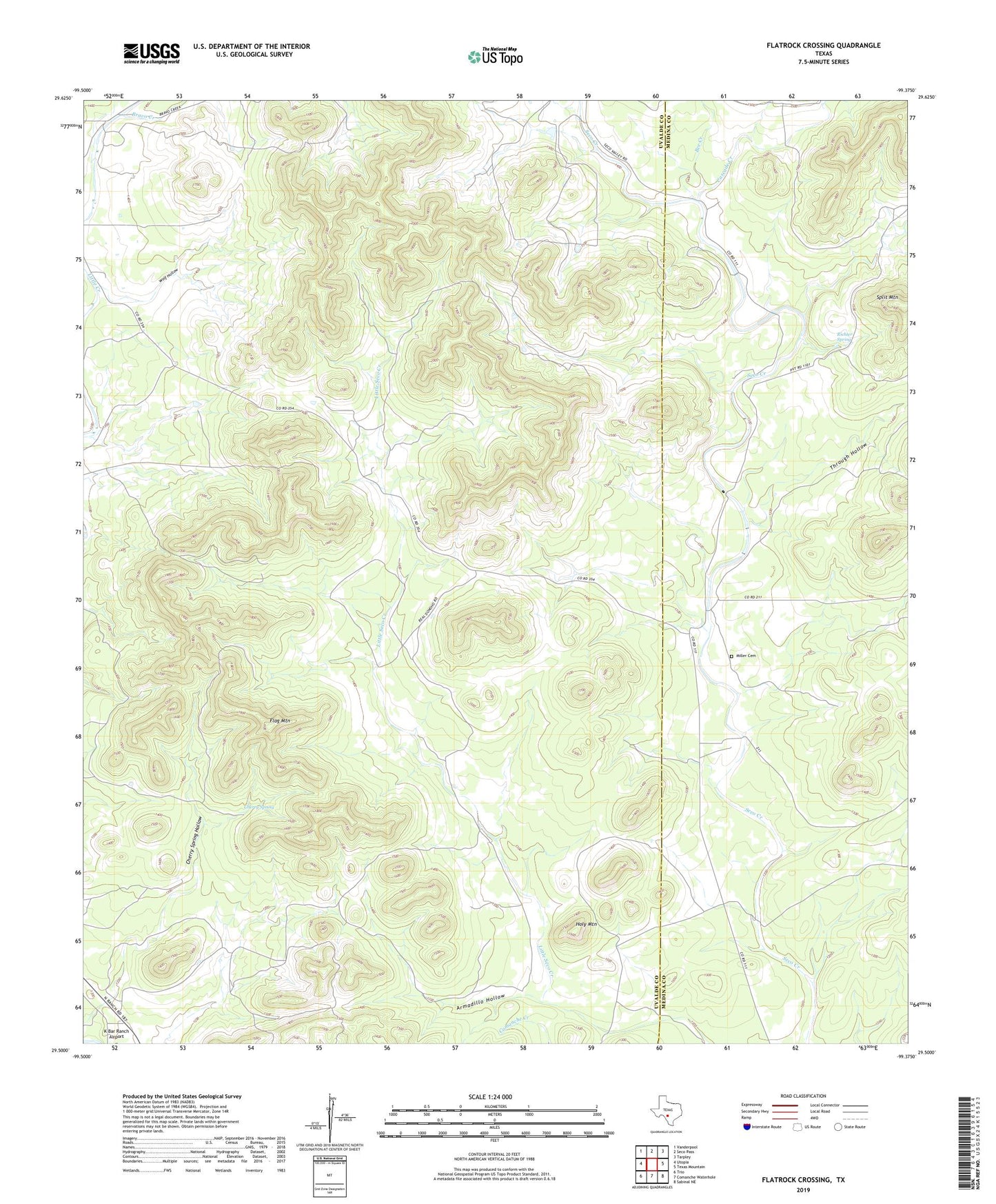
2022 topographic map quadrangle Flatrock Crossing in the state of Texas. Scale: 1:24000. Based on the newly updated USGS 7.5' US Topo map series, this map is in the following counties: Uvalde, Medina. The map contains contour data, water features, and other items you are used to seeing on USGS maps, but also has updated roads and other features. This is the next generation of topographic maps. Printed on high-quality waterproof paper with UV fade-resistant inks.
Quads adjacent to this one:
West: Utopia
Northwest: Vanderpool
North: Seco Pass
Northeast: Tarpley
East: Texas Mountain
Southeast: Sabinal NE
South: Comanche Waterhole
Southwest: Trio
This map covers the same area as the classic USGS quad with code o29099e4.
Contains the following named places: Armadillo Hollow, Bee Creek, Bravo Creek, Cascade Creek, Cherry Spring, Cherry Spring Hollow, Coleman Public Library, Flag Mountain, Flatrock Crossing, Holy Mountain, Miller Cemetery, Richter Spring, Split Mountain, Through Hollow, Wolf Hollow, ZIP Code: 78884