MyTopo
Seco Pass Texas US Topo Map
Couldn't load pickup availability
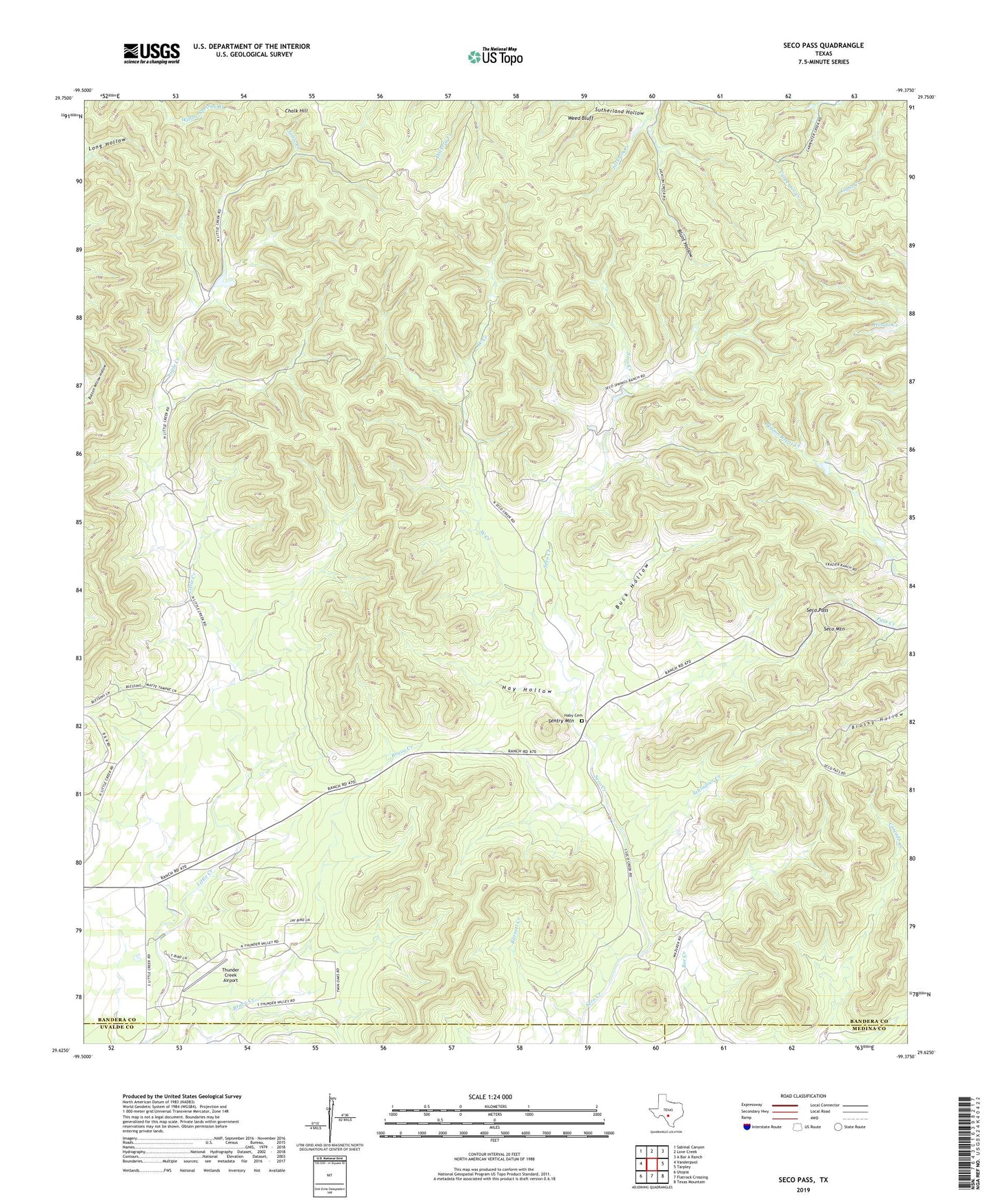
2022 topographic map quadrangle Seco Pass in the state of Texas. Scale: 1:24000. Based on the newly updated USGS 7.5' US Topo map series, this map is in the following counties: Bandera, Uvalde, Medina. The map contains contour data, water features, and other items you are used to seeing on USGS maps, but also has updated roads and other features. This is the next generation of topographic maps. Printed on high-quality waterproof paper with UV fade-resistant inks.
Quads adjacent to this one:
West: Vanderpool
Northwest: Sabinal Canyon
North: Love Creek
Northeast: A Bar A Ranch
East: Tarpley
Southeast: Texas Mountain
South: Flatrock Crossing
Southwest: Utopia
This map covers the same area as the classic USGS quad with code o29099f4.
Contains the following named places: Barnett Creek, Blunt Hollow, Buck Hollow, Chalk Hill, Haby Cemetery, Hay Hollow, Schladoer Creek, Seco Mountain, Seco Pass, Sentry Mountain, Sutherland Hollow, Thunder Creek Airport, Weed Bluff, West Creek