MyTopo
Texas Mountain Texas US Topo Map
Couldn't load pickup availability
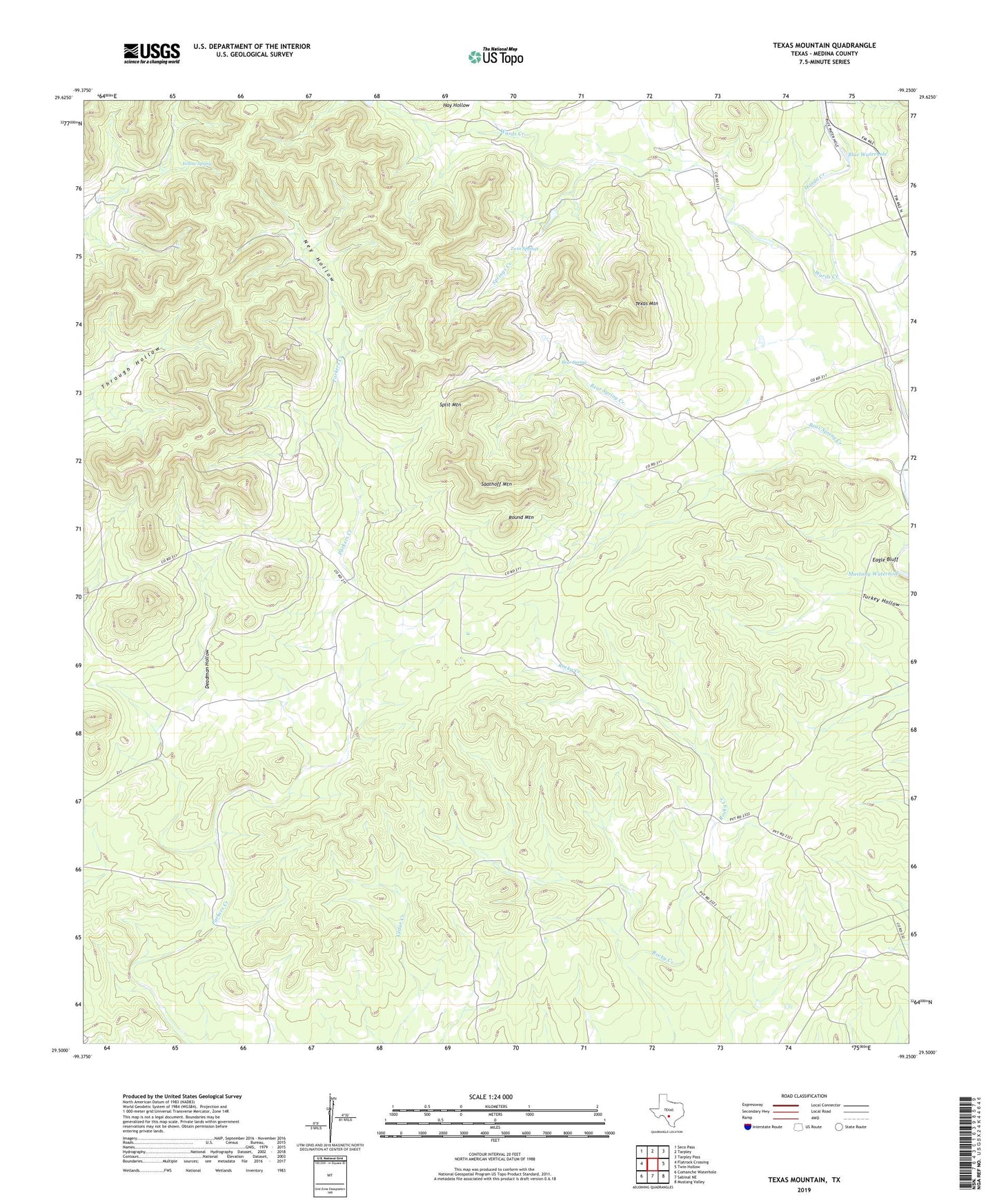
2022 topographic map quadrangle Texas Mountain in the state of Texas. Scale: 1:24000. Based on the newly updated USGS 7.5' US Topo map series, this map is in the following counties: Medina. The map contains contour data, water features, and other items you are used to seeing on USGS maps, but also has updated roads and other features. This is the next generation of topographic maps. Printed on high-quality waterproof paper with UV fade-resistant inks.
Quads adjacent to this one:
West: Flatrock Crossing
Northwest: Seco Pass
North: Tarpley
Northeast: Tarpley Pass
East: Twin Hollow
Southeast: Mustang Valley
South: Sabinal NE
Southwest: Comanche Waterhole
This map covers the same area as the classic USGS quad with code o29099e3.
Contains the following named places: Bandera Creek, Bear Spring, Bear Spring Creek, Blue Waterhole, Camp Mary Louise, Deadman Hollow, Eagle Bluff, Hay Hollow, Ney Hollow, Round Mountain, Saathoff Mountain, Split Mountain, Springs Creek, Texas Mountain, Twin Springs, Wards Creek, Yellow Spring