MyTopo
Crabapple Texas US Topo Map
Couldn't load pickup availability
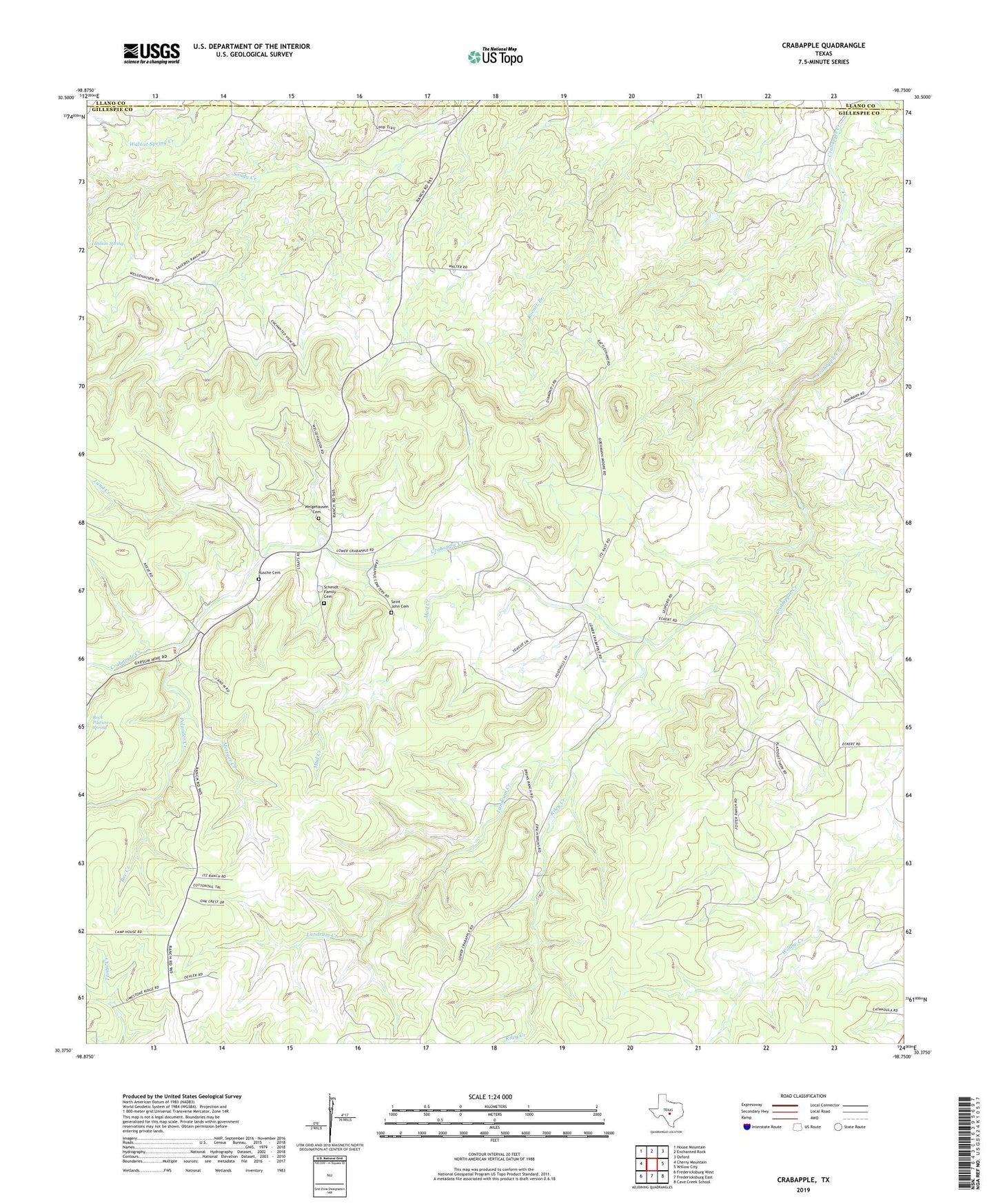
2022 topographic map quadrangle Crabapple in the state of Texas. Scale: 1:24000. Based on the newly updated USGS 7.5' US Topo map series, this map is in the following counties: Gillespie, Llano. The map contains contour data, water features, and other items you are used to seeing on USGS maps, but also has updated roads and other features. This is the next generation of topographic maps. Printed on high-quality waterproof paper with UV fade-resistant inks.
Quads adjacent to this one:
West: Cherry Mountain
Northwest: House Mountain
North: Enchanted Rock
Northeast: Oxford
East: Willow City
Southeast: Cave Creek School
South: Fredericksburg East
Southwest: Fredericksburg West
This map covers the same area as the classic USGS quad with code o30098d7.
Contains the following named places: Bee Creek, Crabapple, Indian Spring, Land Creek, Landrum Creek, Loop Trail, Metzger Creek, Mud Creek, Petersen Site 1 Dam, Petersen Site 1 Lake, Polander Creek, Riley Creek, Rock Pasture Spring, Rusche Cemetery, Saint John Cemetery, Schmidt Family Cemetery, Welgehausen Cemetery