MyTopo
Gail Texas US Topo Map
Couldn't load pickup availability
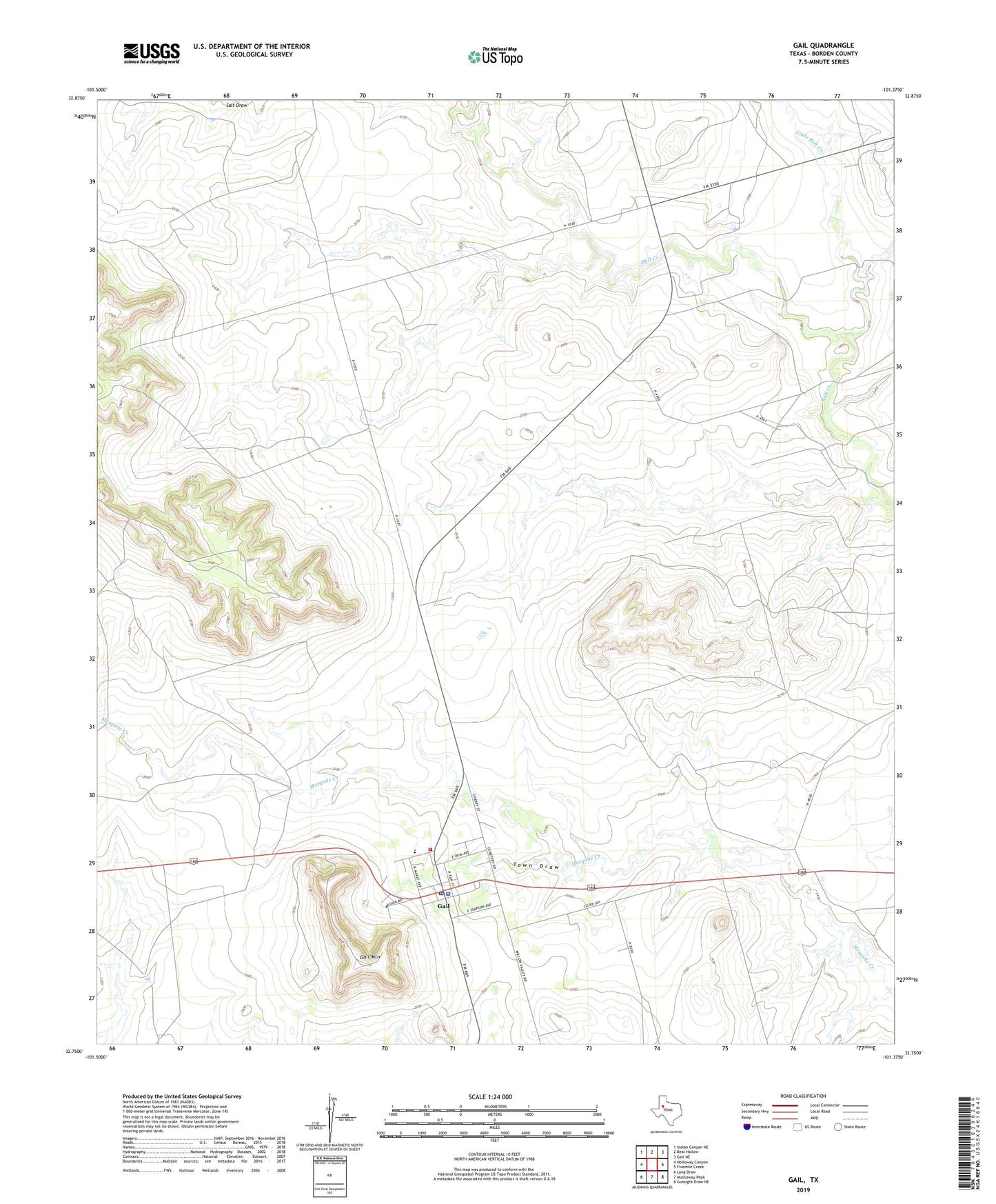
2022 topographic map quadrangle Gail in the state of Texas. Scale: 1:24000. Based on the newly updated USGS 7.5' US Topo map series, this map is in the following counties: Borden. The map contains contour data, water features, and other items you are used to seeing on USGS maps, but also has updated roads and other features. This is the next generation of topographic maps. Printed on high-quality waterproof paper with UV fade-resistant inks.
Quads adjacent to this one:
West: Holloway Canyon
Northwest: Indian Canyon NE
North: Beal Hollow
Northeast: Gail NE
East: Fivemile Creek
Southeast: Gunsight Draw NE
South: Mushaway Peak
Southwest: Long Draw
This map covers the same area as the classic USGS quad with code o32101g4.
Contains the following named places: Borden County Emergency Medical Services, Borden County Jail, Borden County Sheriff's Office, Borden County Volunteer Fire Department, Flying D Ranch, Gail, Gail Census Designated Place, Gail Mountain, Gail Post Office, Little Bull Creek, Town Draw, ZIP Code: 79738