MyTopo
Goofy Lake Texas US Topo Map
Couldn't load pickup availability
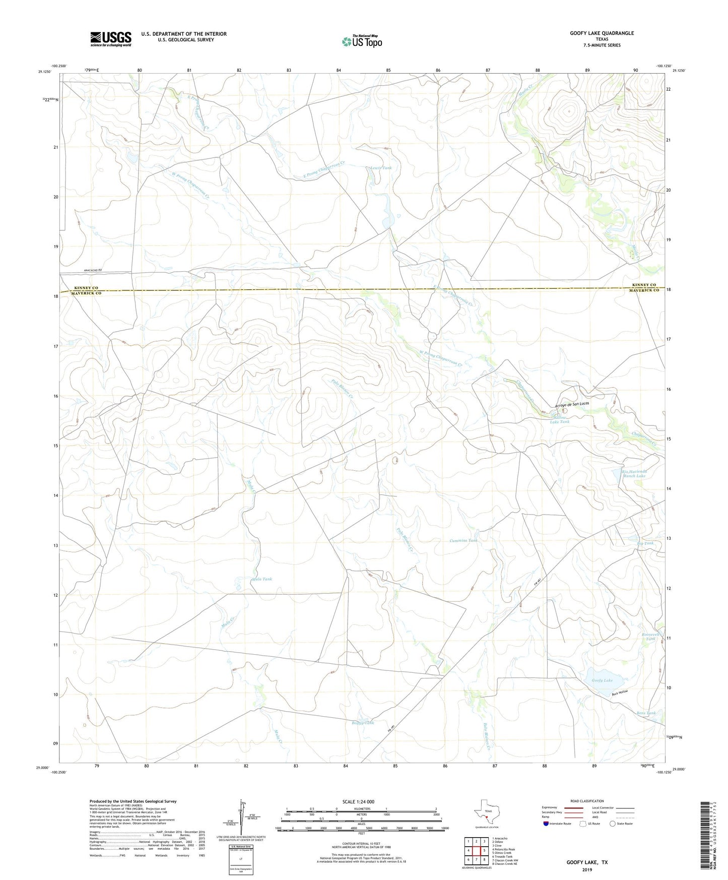
2022 topographic map quadrangle Goofy Lake in the state of Texas. Scale: 1:24000. Based on the newly updated USGS 7.5' US Topo map series, this map is in the following counties: Maverick, Kinney. The map contains contour data, water features, and other items you are used to seeing on USGS maps, but also has updated roads and other features. This is the next generation of topographic maps. Printed on high-quality waterproof paper with UV fade-resistant inks.
Quads adjacent to this one:
West: Peloncillo Peak
Northwest: Anacacho
North: Odlaw
Northeast: Cline
East: Olmos Creek
Southeast: Chacon Creek NE
South: Chacon Creek NW
Southwest: Trosado Tank
This map covers the same area as the classic USGS quad with code o29100a2.
Contains the following named places: Bens Tank, Big Tank, Boggy Tank, Cummins Tank, East Prong Chaparrosa Creek, Goofy Lake, Goofy Lake Dam, Holmgreen Ranch, Holmgreen Ranch Airport, Lewis Tank, Mula Tank, Rio Hacienda Ranch Lake, Rio Hacienda Ranch Lake Dam, Roosevelt Tank, West Prong Chaparrosa Creek, Willow Lake Tank