MyTopo
Miles NW Texas US Topo Map
Couldn't load pickup availability
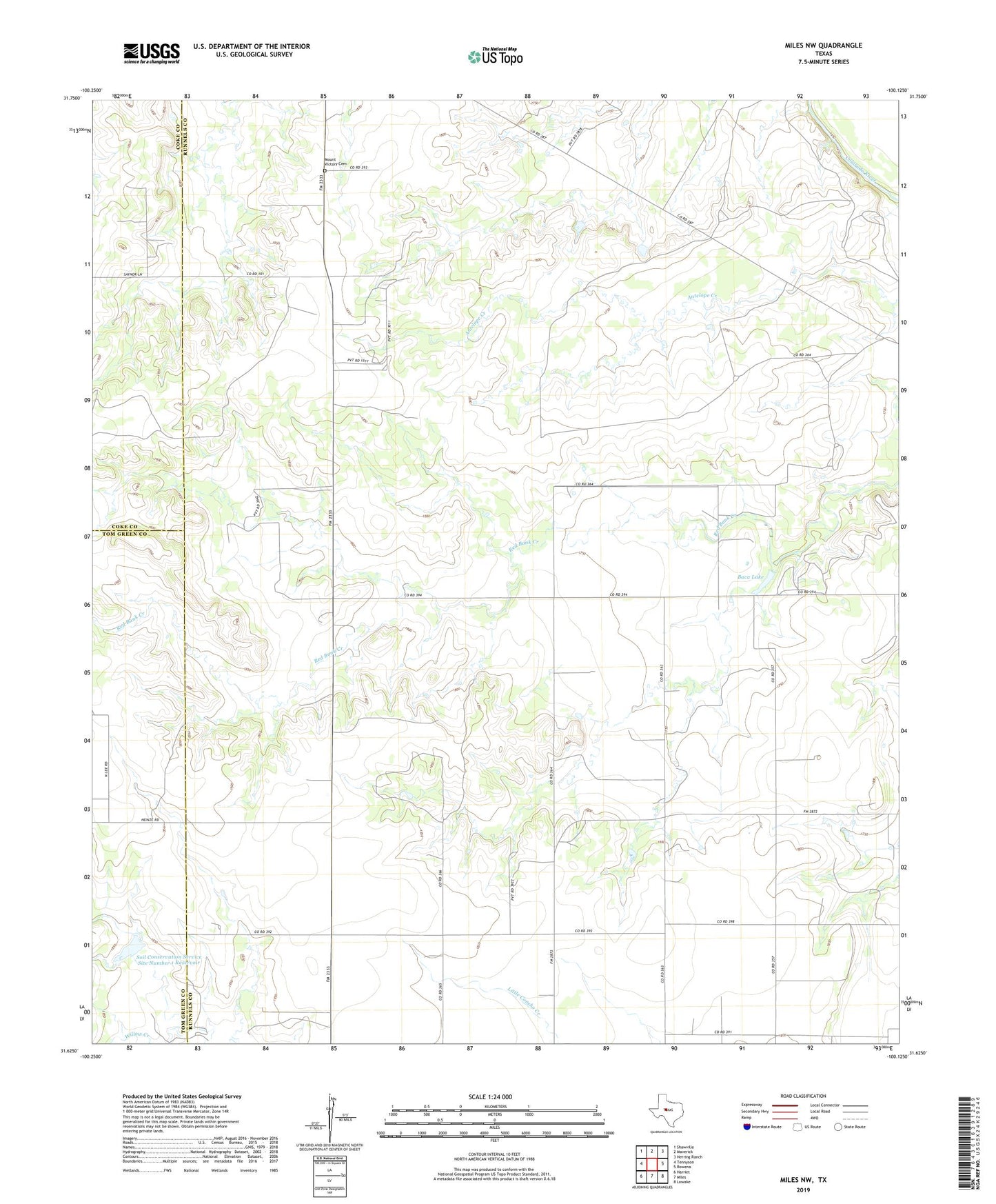
2022 topographic map quadrangle Miles NW in the state of Texas. Scale: 1:24000. Based on the newly updated USGS 7.5' US Topo map series, this map is in the following counties: Runnels, Tom Green, Coke. The map contains contour data, water features, and other items you are used to seeing on USGS maps, but also has updated roads and other features. This is the next generation of topographic maps. Printed on high-quality waterproof paper with UV fade-resistant inks.
Quads adjacent to this one:
West: Tennyson
Northwest: Shawville
North: Maverick
Northeast: Herring Ranch
East: Rowena
Southeast: Lowake
South: Miles
Southwest: Harriet
This map covers the same area as the classic USGS quad with code o31100f2.
Contains the following named places: Baca Lake, Baca Lake Dam, Brookshire Cemetery, Miles Division, Soil Conservation Service Site Dam Number 1, Soil Conservation Service Site Number 1 Reservoir