MyTopo
Hartland Texas US Topo Map
Couldn't load pickup availability
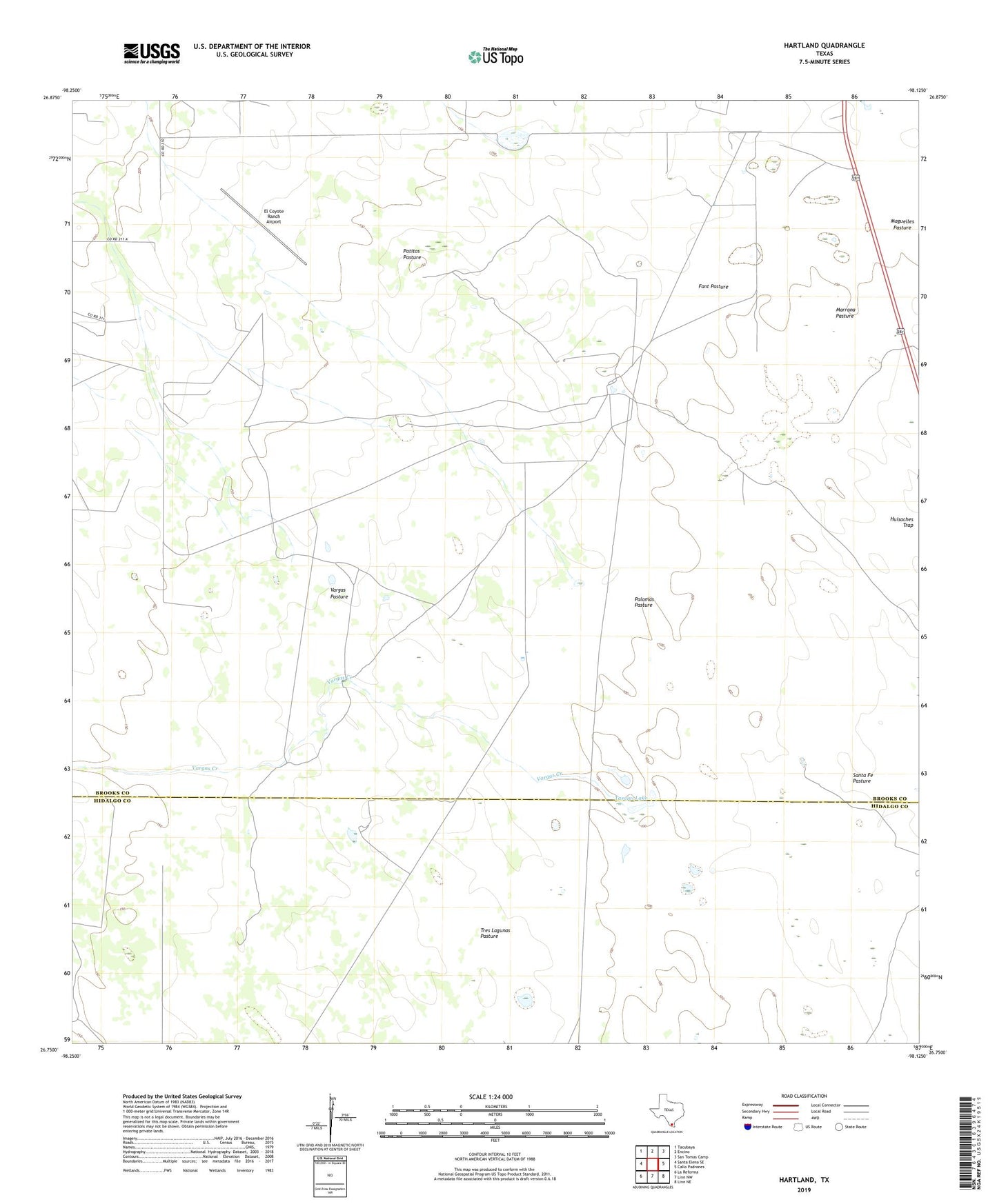
2019 topographic map quadrangle Hartland in the state of Texas. Scale: 1:24000. Based on the newly updated USGS 7.5' US Topo map series, this map is in the following counties: Brooks, Hidalgo. The map contains contour data, water features, and other items you are used to seeing on USGS maps, but also has updated roads and other features. This is the next generation of topographic maps. Printed on high-quality waterproof paper with UV fade-resistant inks.
Quads adjacent to this one:
West: Santa Elena SE
Northwest: Tacubaya
North: Encino
Northeast: San Tomas Camp
East: Callo Padrones
Southeast: Linn NE
South: Linn NW
Southwest: La Reforma
Contains the following named places: Bacera Windmill, Buena Suerte Windmill, Coyote Ranch, Cuero de Venada Windmill, El Coyote Ranch Airport, Encalmado Windmill, Encinal Windmill, Fant Pasture, Fant Windmill, Hartland, La Blanca Windmill, La Merienda Windmill, Llano Windmill, Los Aceiteros Windmill, Machos Windmill, Marrana Pasture, Medanito Windmill, Mesquite Windmill, Old Coyote Windmill, Palomas Pasture, Palomas Windmill, Patitos Pasture, Pens Windmill, Plato Windmill, Prieto Windmill, Quaco Windmill, Sulphur Windmill, Tasajal Lake, Tordillas Windmill, Tres Lagunas Pasture, Tuerto Windmill, Vargas Creek, Vargas Pasture, Vargas Windmill, Venada Windmill