MyTopo
Harvard Texas US Topo Map
Couldn't load pickup availability
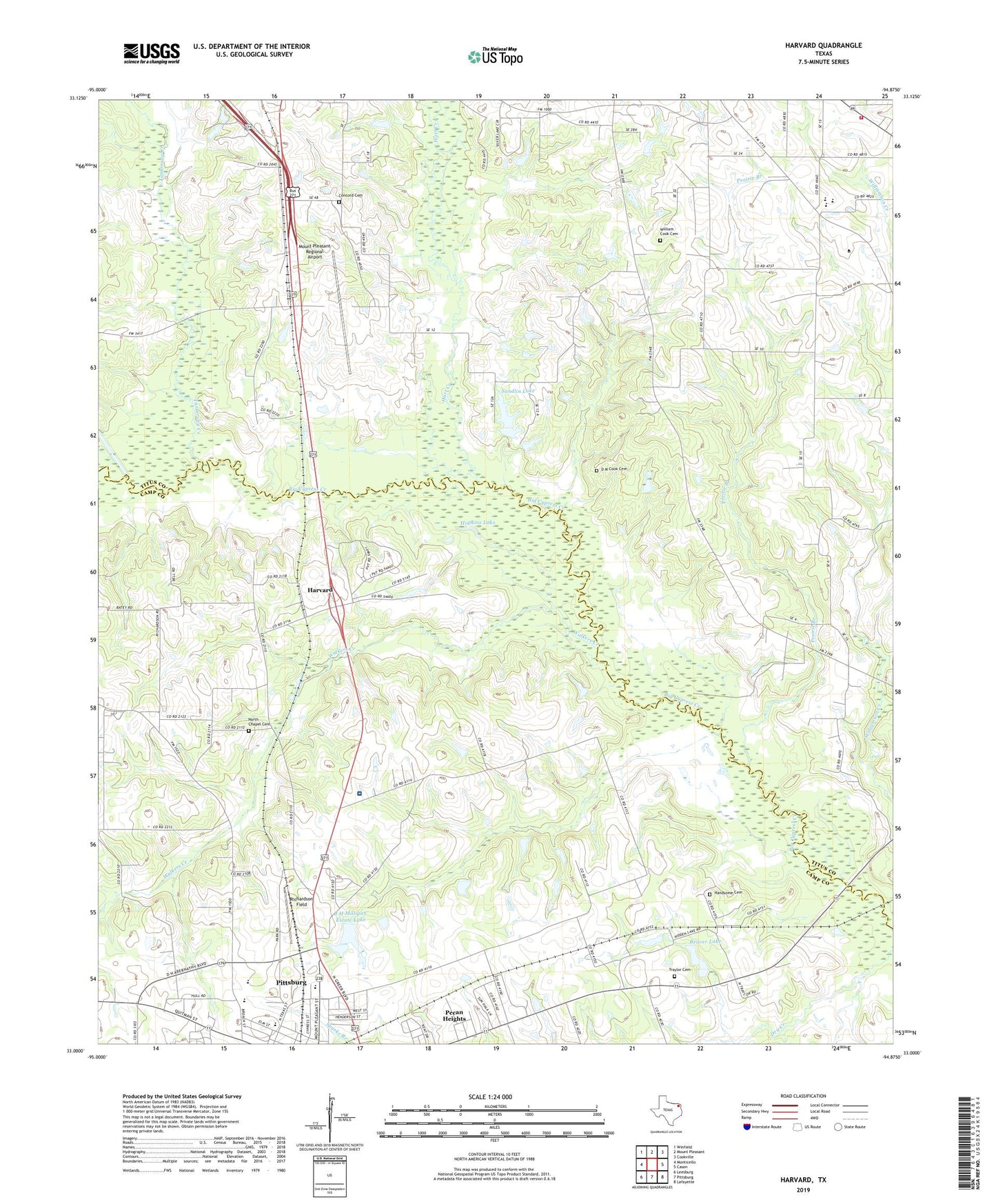
2019 topographic map quadrangle Harvard in the state of Texas. Scale: 1:24000. Based on the newly updated USGS 7.5' US Topo map series, this map is in the following counties: Titus, Camp. The map contains contour data, water features, and other items you are used to seeing on USGS maps, but also has updated roads and other features. This is the next generation of topographic maps. Printed on high-quality waterproof paper with UV fade-resistant inks.
Quads adjacent to this one:
West: Monticello
Northwest: Winfield
North: Mount Pleasant
Northeast: Cookville
East: Cason
Southeast: Lafayette
South: Pittsburg
Southwest: Leesburg
Contains the following named places: Beaver Club Dam, Beaver Lake, Chapel Hill School, Church of God, Concord Cemetery, Cook Cemetery, Cypress Church, Deishler John Freedom Fellowship Church, East New Hope Church, East Texas Medical Center, Faker, Handsome Cemetery, Hart Creek, Harvard, Hopkins Lake, J H Milligan Estate Dam, J H Milligan Estate Lake, Lang Chapel, Macedonia, Mount Pleasant Regional Airport, Nortex Volunteer Fire Department, North Chapel, North Chapel Cemetery, Pecan Heights, Pittsburg Middle School, Pittsburg Primary School, Polk Ranch Airport, Prairie Branch, Richardson Field, Sandlin Lake, Sandlin Lake Dam, Spring Hill, Tankersley Creek, Tiddle Lake, Traylor Cemetery, Walkers Creek, William Cook Cemetery