MyTopo
Cookville Texas US Topo Map
Couldn't load pickup availability
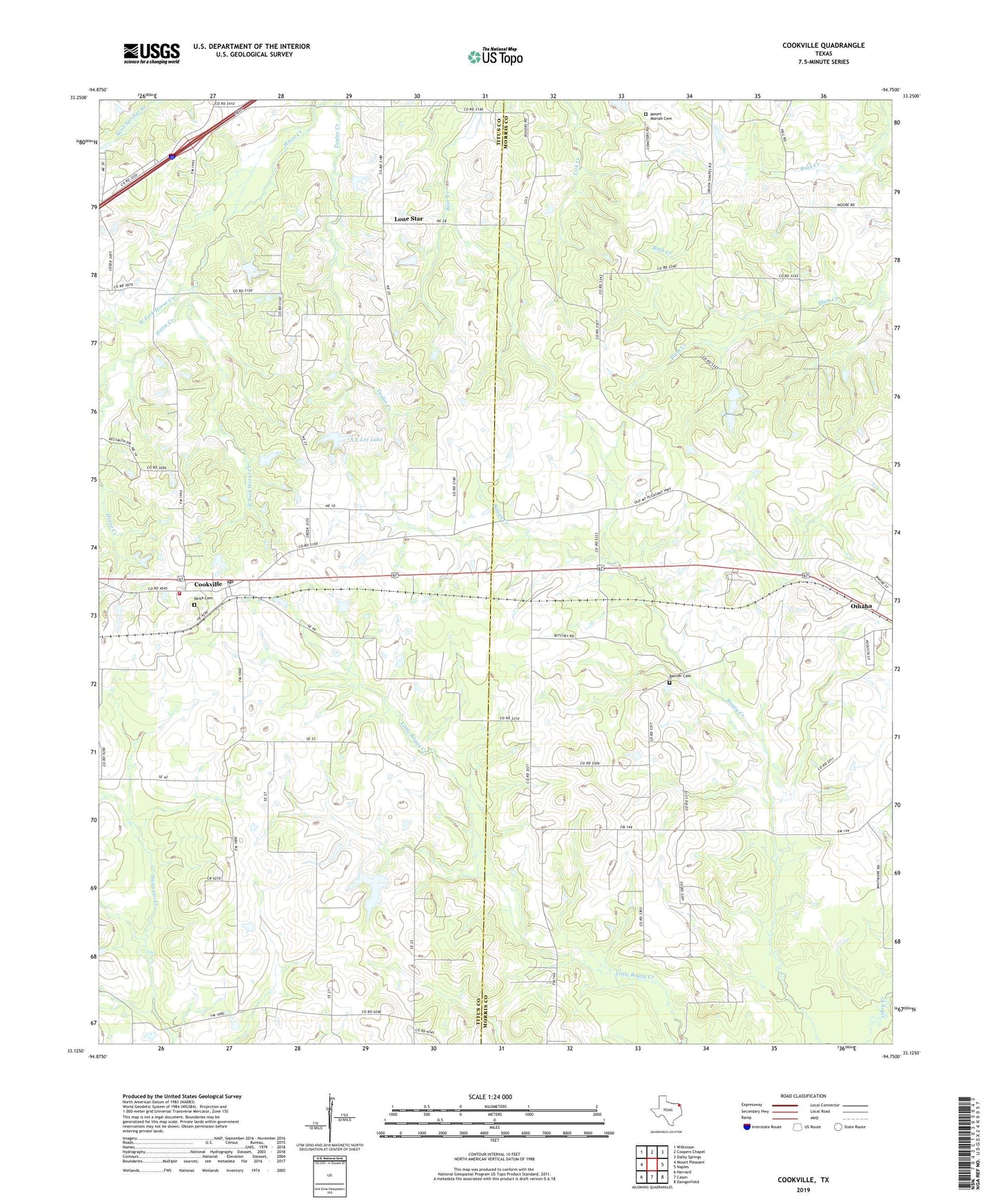
2022 topographic map quadrangle Cookville in the state of Texas. Scale: 1:24000. Based on the newly updated USGS 7.5' US Topo map series, this map is in the following counties: Morris, Titus. The map contains contour data, water features, and other items you are used to seeing on USGS maps, but also has updated roads and other features. This is the next generation of topographic maps. Printed on high-quality waterproof paper with UV fade-resistant inks.
Quads adjacent to this one:
West: Mount Pleasant
Northwest: Wilkinson
North: Coopers Chapel
Northeast: Dalby Springs
East: Naples
Southeast: Daingerfield
South: Cason
Southwest: Harvard
This map covers the same area as the classic USGS quad with code o33094b7.
Contains the following named places: Barrier Cemetery, Center Grove, Concord Church, Cookville, Cookville Division, Cookville Post Office, Cookville Volunteer Fire Department, East Fork Horse Creek, Keith Cemetery, Kenneth Travis Lake, Kenneth Travis Lake Dam, Lone Star, Mount Moriah Cemetery, Mount Moriah Church, Pleasant Grove Church, S E Lee Dam, S E Lee Lake, West Fork Horse Creek, ZIP Codes: 75558, 75571