MyTopo
Cason Texas US Topo Map
Couldn't load pickup availability
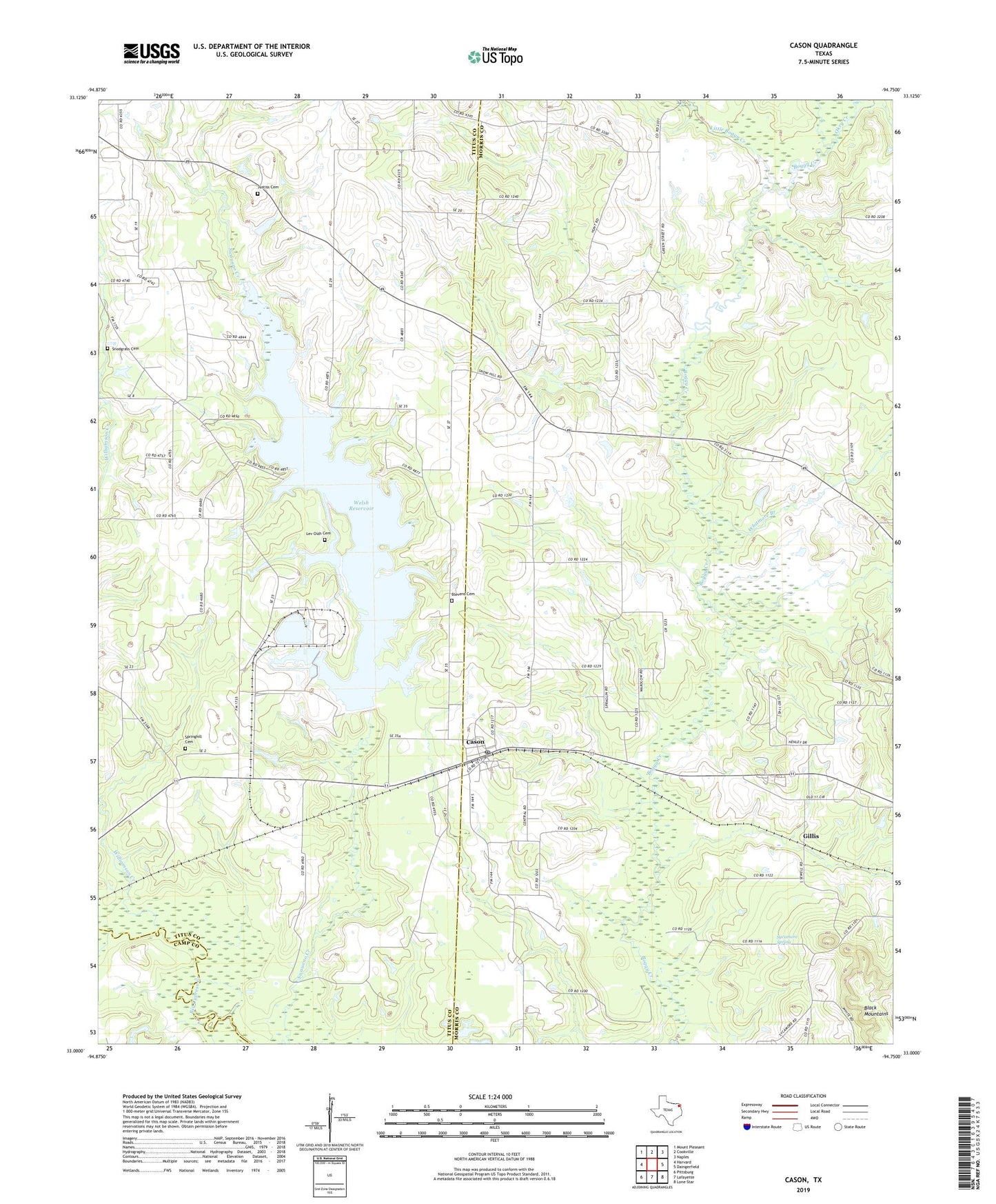
2022 topographic map quadrangle Cason in the state of Texas. Scale: 1:24000. Based on the newly updated USGS 7.5' US Topo map series, this map is in the following counties: Morris, Titus, Camp. The map contains contour data, water features, and other items you are used to seeing on USGS maps, but also has updated roads and other features. This is the next generation of topographic maps. Printed on high-quality waterproof paper with UV fade-resistant inks.
Quads adjacent to this one:
West: Harvard
Northwest: Mount Pleasant
North: Cookville
Northeast: Naples
East: Daingerfield
Southeast: Lone Star
South: Lafayette
Southwest: Pittsburg
This map covers the same area as the classic USGS quad with code o33094a7.
Contains the following named places: Blevens Cemetery, Cason, Cason Post Office, Central Grove School, Dry Creek, Gillis, Hickory Hill Church, Justiss Cemetery, Justiss Creek, Lev Olds Cemetery, Little Boggy Creek, Mount Mitchell, Mount Moriah Church, Okry Creek, Roeder, Shady Grove Church, Snodgrass Cemetery, Snow Hill Church, Spring Hill Church, Springhill Cemetery, Sycamore Spring, Welsh Dam, Welsh Reservoir, Whitmore Branch, Williamson Creek