MyTopo
Shingle Hills Texas US Topo Map
Couldn't load pickup availability
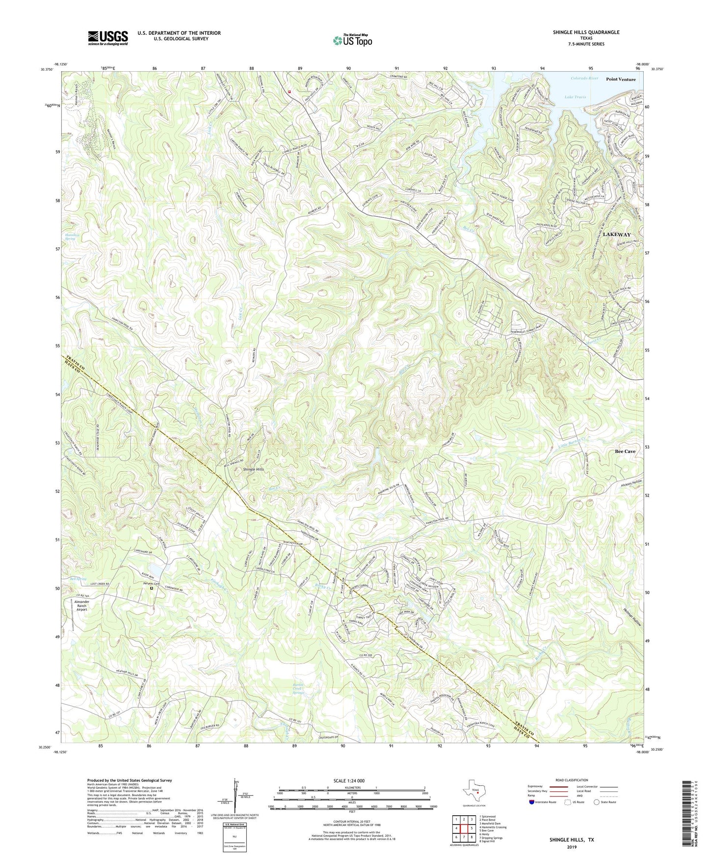
2022 topographic map quadrangle Shingle Hills in the state of Texas. Scale: 1:24000. Based on the newly updated USGS 7.5' US Topo map series, this map is in the following counties: Travis, Hays. The map contains contour data, water features, and other items you are used to seeing on USGS maps, but also has updated roads and other features. This is the next generation of topographic maps. Printed on high-quality waterproof paper with UV fade-resistant inks.
Quads adjacent to this one:
West: Hammetts Crossing
Northwest: Spicewood
North: Pace Bend
Northeast: Mansfield Dam
East: Bee Cave
Southeast: Signal Hill
South: Dripping Springs
Southwest: Henly
This map covers the same area as the classic USGS quad with code o30098c1.
Contains the following named places: Alexander Ranch Airport, Austin / Travis County Emergency Medical Service - Rescue 26, Barton Creek Springs, Bee Creek, Bell Spring, Hamilton Spring, Ohho Airport, Peryear Cemetery, Shingle Hills, Southwest Travis Division, Travis County Emergency Services District 8 Station 2 Pedernales