MyTopo
Hill City Texas US Topo Map
Couldn't load pickup availability
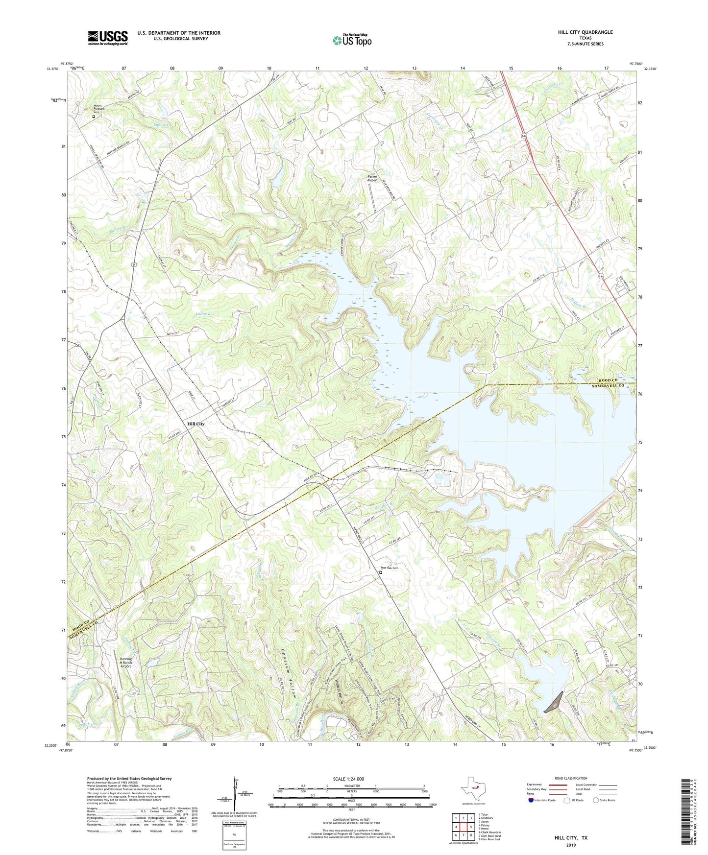
2019 topographic map quadrangle Hill City in the state of Texas. Scale: 1:24000. Based on the newly updated USGS 7.5' US Topo map series, this map is in the following counties: Hood, Somervell. The map contains contour data, water features, and other items you are used to seeing on USGS maps, but also has updated roads and other features. This is the next generation of topographic maps. Printed on high-quality waterproof paper with UV fade-resistant inks.
Quads adjacent to this one:
West: Paluxy
Northwest: Tolar
North: Granbury
Northeast: Acton
East: Nemo
Southeast: Glen Rose East
South: Glen Rose West
Southwest: Chalk Mountain
Contains the following named places: Cedar Brake, Comanche Peak Nuclear Power Plant Ambulance, Denio Branch, Dinosaur Valley State Park, Dinosaur Valley State Park Trail, Hill City, Lollar Branch, Mambrino Baptist Church, Million Branch, Mount Pleasant Cemetery, Neri, Neri School, Opossum Branch, Opossum Hollow, Panter Branch, Panther Branch, Parker Airport, Post Oak Cemetery, Prairie Creek Church, Rough Creek, Running M Ranch Airport, Safe Shutdown Impoundment, Safe Shutdown Impoundment Dam, Somervell County Jail, Somervell County Sheriff's Office, Squaw Creek Dam, Squaw Creek Reservoir, Wildcat Hollow