MyTopo
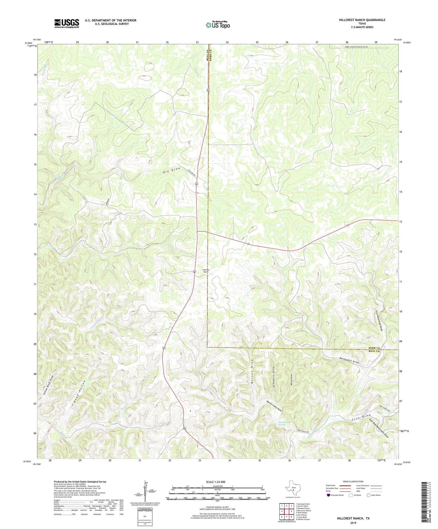
Hillcrest Ranch Texas US Topo Map
Couldn't load pickup availability
2022 topographic map quadrangle Hillcrest Ranch in the state of Texas. Scale: 1:24000. Based on the newly updated USGS 7.5' US Topo map series, this map is in the following counties: Real, Kerr. The map contains contour data, water features, and other items you are used to seeing on USGS maps, but also has updated roads and other features. This is the next generation of topographic maps. Printed on high-quality waterproof paper with UV fade-resistant inks.
Quads adjacent to this one:
West: Bee Cave Hollow
Northwest: Earwood Creek
North: Garven Store
Northeast: Boneyard Draw
East: Well Hollow
Southeast: Sabinal Canyon
South: Circle Bluff
Southwest: Owl Hollow
This map covers the same area as the classic USGS quad with code o29099h6.
Contains the following named places: Armadillo Draw, Auld Ranch, Big Draw, Bushwack Draw, Chittim Ranch, Frio Draw, Frio Ranch, Frio Waterhole, Frio Waterhole Draw, Haby Ranch, Hillcrest Ranch, Love Ranch, Martin Camp Draw, Martin Camp Spring, Maverick Windmill, Old Windmill, Post Oak Waterhole Draw, Road Hollow, Walnut Draw, Willow Draw, Wilson Ranch