MyTopo
Humdinger Spring Texas US Topo Map
Couldn't load pickup availability
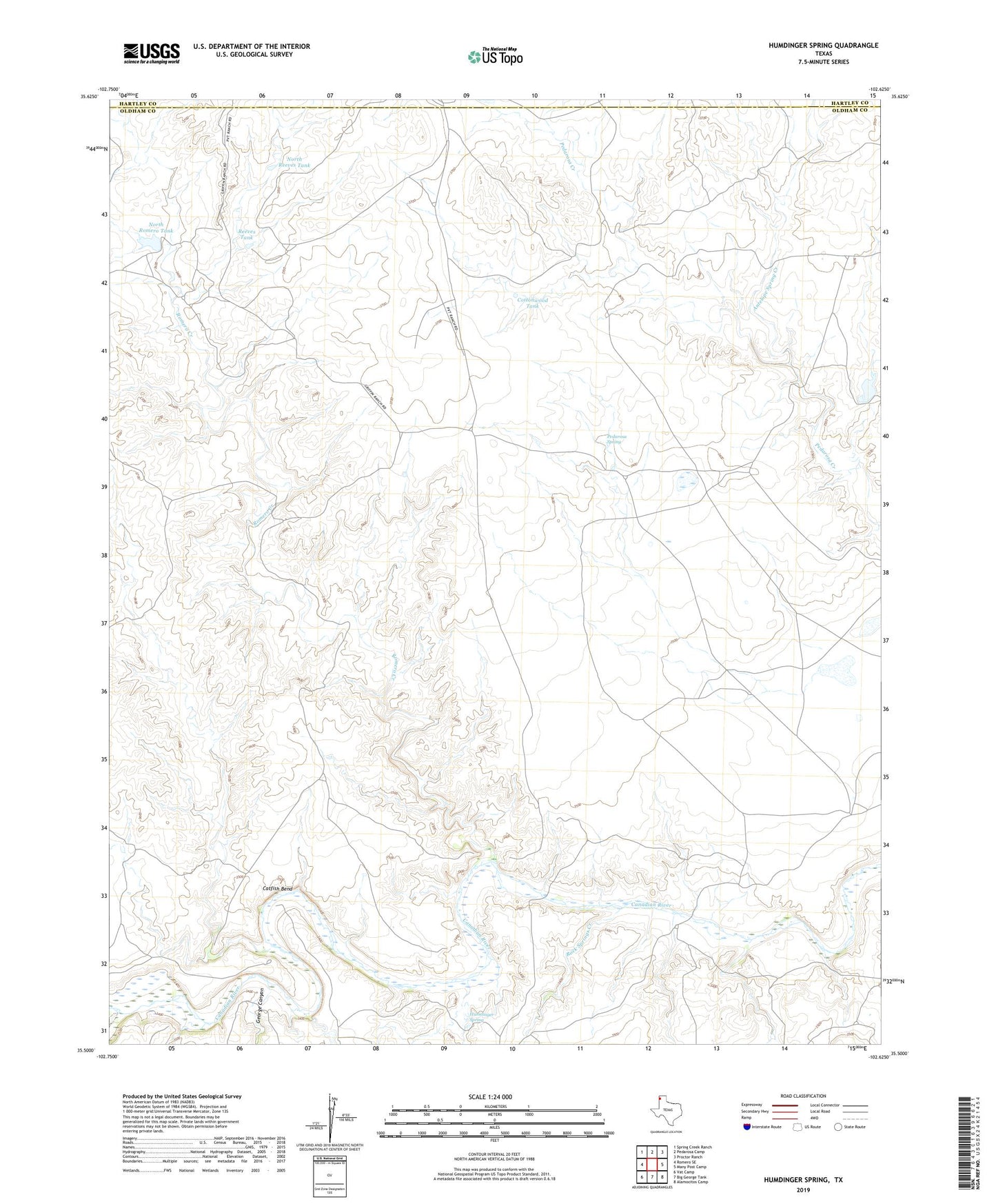
2022 topographic map quadrangle Humdinger Spring in the state of Texas. Scale: 1:24000. Based on the newly updated USGS 7.5' US Topo map series, this map is in the following counties: Oldham, Hartley. The map contains contour data, water features, and other items you are used to seeing on USGS maps, but also has updated roads and other features. This is the next generation of topographic maps. Printed on high-quality waterproof paper with UV fade-resistant inks.
Quads adjacent to this one:
West: Romero SE
Northwest: Spring Creek Ranch
North: Pedarosa Camp
Northeast: Proctor Ranch
East: Many Post Camp
Southeast: Alamocitos Camp
South: Big George Tank
Southwest: Vat Camp
This map covers the same area as the classic USGS quad with code o35102e6.
Contains the following named places: Antelope Spring Creek, Buck Arroyo, Catfish Bend, Cottonwood Tank, East Romero Windmill, George Canyon, High Lonesome Windmill, Humdinger Spring, Las Arches Creek, Martha Houghton Lake Number 5 Dam, Mouse Windmill, North Reeves Tank, North Romero Tank, Partwood Crossing, Pedarosa Spring, Pedarosa Springs, Pedarosa Vats Windmill, Rachel Windmill, Reeves Tank, Rock Springs Creek, Romero Creek, South Romero Windmill, Southeast Windmill, Southwest Windmill, Strip Crossing, Weak Windmill