MyTopo
Romero SE Texas US Topo Map
Couldn't load pickup availability
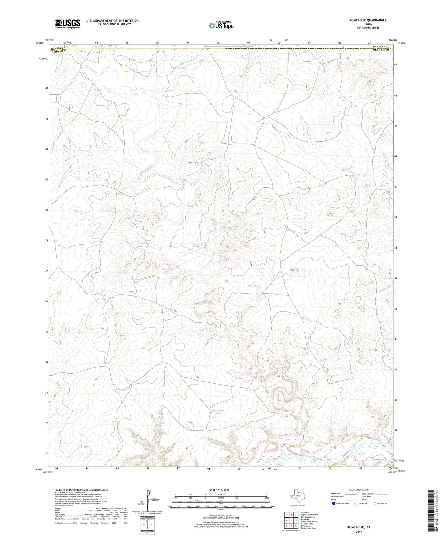
2022 topographic map quadrangle Romero SE in the state of Texas. Scale: 1:24000. Based on the newly updated USGS 7.5' US Topo map series, this map is in the following counties: Oldham, Hartley. The map contains contour data, water features, and other items you are used to seeing on USGS maps, but also has updated roads and other features. This is the next generation of topographic maps. Printed on high-quality waterproof paper with UV fade-resistant inks.
Quads adjacent to this one:
West: Knoblaw
Northwest: Romero
North: Spring Creek Ranch
Northeast: Pedarosa Camp
East: Humdinger Spring
Southeast: Big George Tank
South: Vat Camp
Southwest: Trujillo Camp
This map covers the same area as the classic USGS quad with code o35102e7.
Contains the following named places: Corner Windmill, Cottonwood Windmill, Division Windmill, East Chavez Windmill, Freeze Out Windmill, Hay Creek, Horseshoe Tank, Minneosa Creek, Minneosa Windmill, New Wildcat Windmill, Old Santa Fe Windmill, Old Wildcat Windmill, Poison Oak Windmill, Red Tank, Smitty Windmill, Spring Creek, Three-Way Windmill, Van Tyle Tank, Van Tyle Windmill, Wooden Tower Windmill