MyTopo
Kendalia Texas US Topo Map
Couldn't load pickup availability
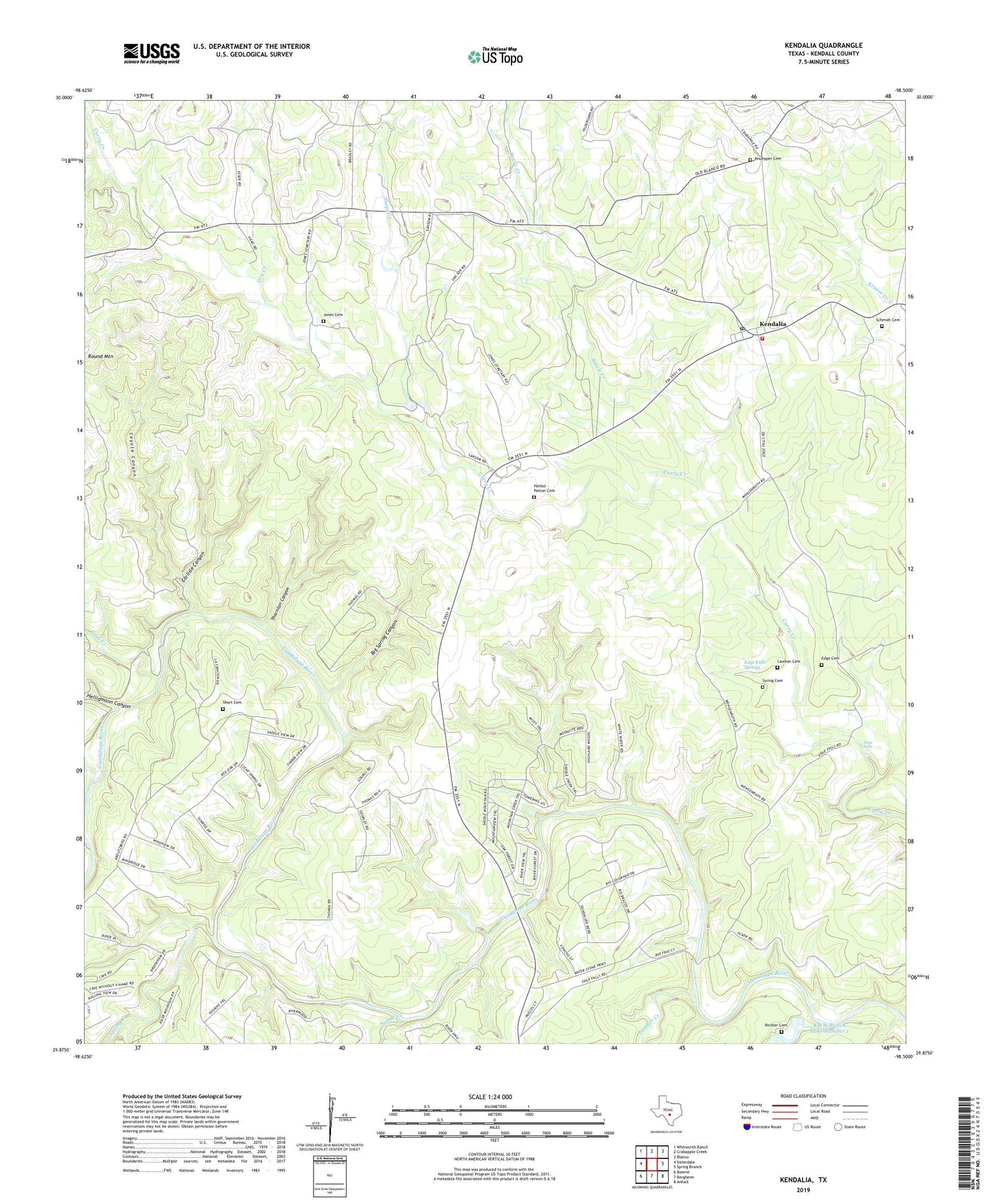
2019 topographic map quadrangle Kendalia in the state of Texas. Scale: 1:24000. Based on the newly updated USGS 7.5' US Topo map series, this map is in the following counties: Kendall. The map contains contour data, water features, and other items you are used to seeing on USGS maps, but also has updated roads and other features. This is the next generation of topographic maps. Printed on high-quality waterproof paper with UV fade-resistant inks.
Quads adjacent to this one:
West: Sisterdale
Northwest: Whitworth Ranch
North: Crabapple Creek
Northeast: Blanco
East: Spring Branch
Southeast: Anhalt
South: Bergheim
Southwest: Boerne
Contains the following named places: Big Spring Canyon, Carlisle Canyon, Coyote Canyon, Dry Creek, Edge Cemetery, Edge Falls, Edge Falls Springs, Goss Creek, Heiliqmann Canyon, Herbst - Patton Cemetery, Jones Cemetery, Kendalia, Kendalia Community Church, Kendalia Post Office, Kendalia Public Library, Kendalia Volunteer Fire Department, Knuepper Cemetery, KWW Ranch Lake Number 1, KWW Ranch Lake Number 1 Dam, Lawhon Cemetery, Oberly Crossing, Panther Creek, Rawls Creek, Richter Cemetery, Ross Creek, Round Mountain, Schmidt Cemetery, Sheps Creek, Short Cemetery, Spring Creek, Swede Creek, Syring Cemetery, Thornton Canyon, Walter Creek, ZIP Codes: 78004, 78027