MyTopo
Smithland Texas US Topo Map
Couldn't load pickup availability
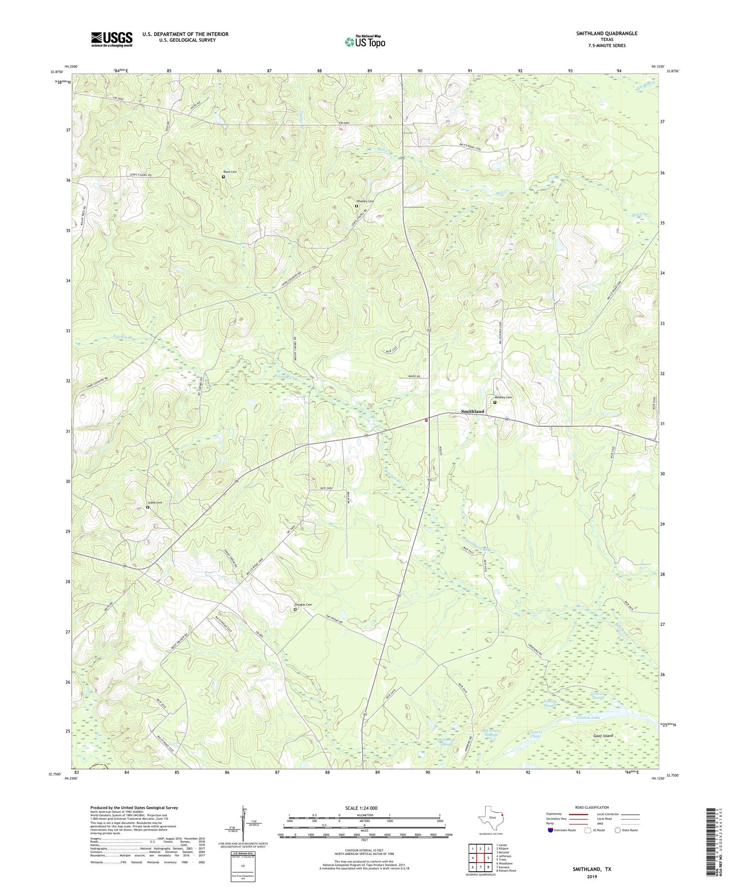
2022 topographic map quadrangle Smithland in the state of Texas. Scale: 1:24000. Based on the newly updated USGS 7.5' US Topo map series, this map is in the following counties: Marion, Harrison. The map contains contour data, water features, and other items you are used to seeing on USGS maps, but also has updated roads and other features. This is the next generation of topographic maps. Printed on high-quality waterproof paper with UV fade-resistant inks.
Quads adjacent to this one:
West: Jefferson
Northwest: Lanier
North: Kildare
Northeast: McLeod
East: Trees
Southeast: Potters Point
South: Karnack
Southwest: Woodlawn
This map covers the same area as the classic USGS quad with code o32094g2.
Contains the following named places: Belview Church, Bethel Church, Douglas Cemetery, Douglas Chapel, Goat Island, Gravier Slough, Jefferson Division, Jenkins Slough, Judea Cemetery, Judea Church, Logan Chapel, Moseley Cemetery, Mount Carmel Church, Mount Maria Church, Old House Slough, Patterson Slough, Rand Cemetery, Savannah Church, Shady Grove Church, Smithland, Smithland Branch, Smithland Volunteer Fire Department, Whatley Cemetery