MyTopo
Knoblaw Texas US Topo Map
Couldn't load pickup availability
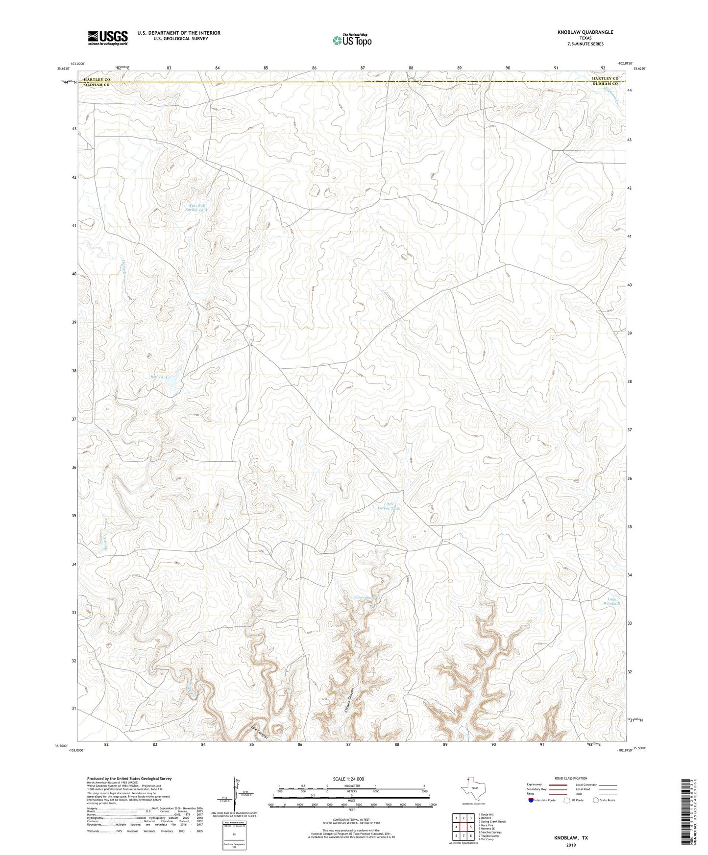
2022 topographic map quadrangle Knoblaw in the state of Texas. Scale: 1:24000. Based on the newly updated USGS 7.5' US Topo map series, this map is in the following counties: Oldham, Hartley. The map contains contour data, water features, and other items you are used to seeing on USGS maps, but also has updated roads and other features. This is the next generation of topographic maps. Printed on high-quality waterproof paper with UV fade-resistant inks.
Quads adjacent to this one:
West: Nara Visa
Northwest: Doyle Hill
North: Romero
Northeast: Spring Creek Ranch
East: Romero SE
Southeast: Vat Camp
South: Trujillo Camp
This map covers the same area as the classic USGS quad with code o35102e8.
Contains the following named places: Big Forker Well, Bull Springs Well, Chisum Spring, Corner Well, East Well, Jonah Well, Knoblaw, Lake Windmill, Little Forker Tank, Little Pasture Well, Red Tank, Sidle Canyon, South Santa Fe Windmill, Thousand Dollar Dam, Trujillo Well, Twelve Section Well, West Bull Spring Tank, West Chavez Windmill