MyTopo
Lake Nacogdoches South Texas US Topo Map
Couldn't load pickup availability
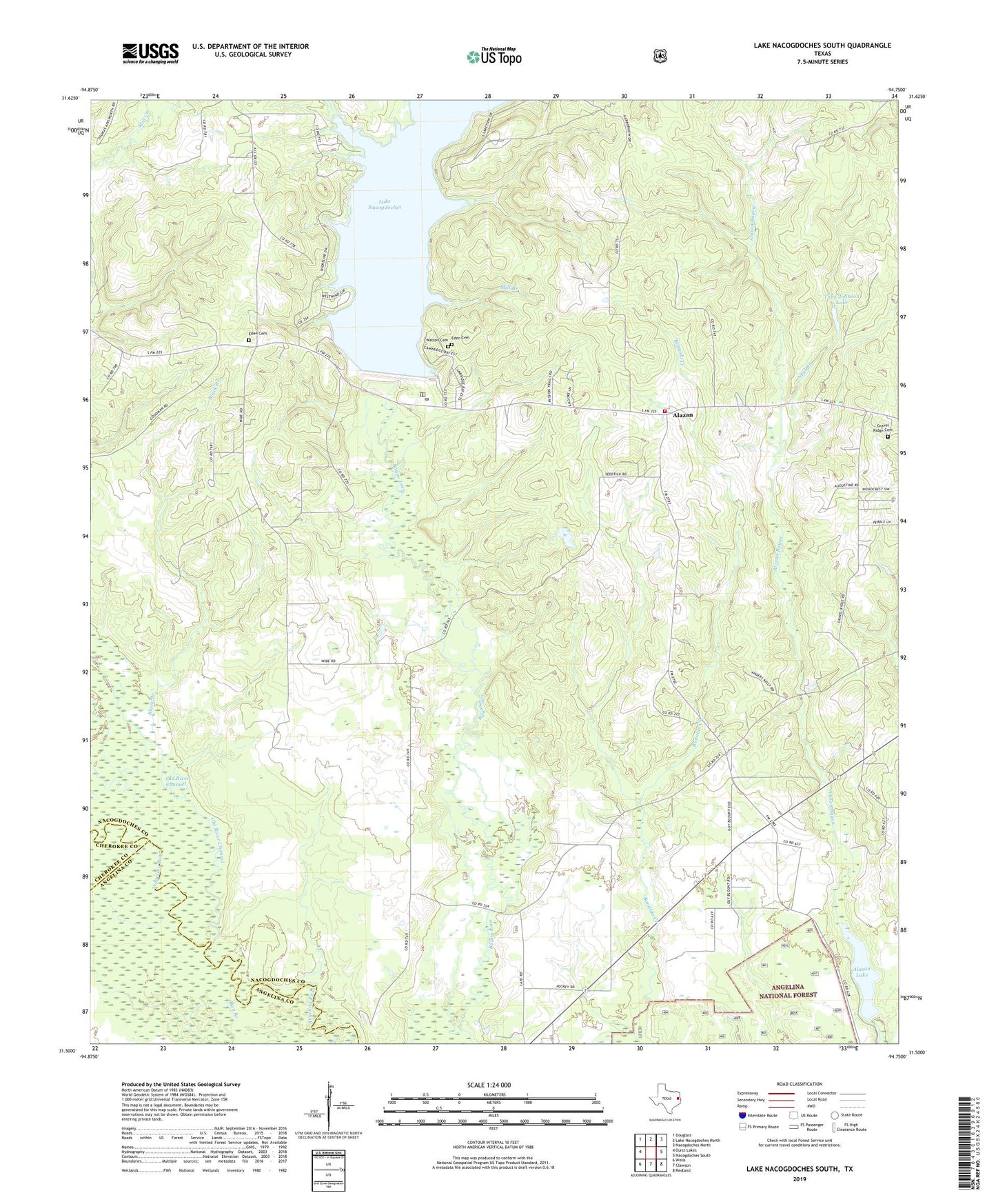
2019 topographic map quadrangle Lake Nacogdoches South in the state of Texas. Scale: 1:24000. Based on the newly updated USGS 7.5' US Topo map series, this map is in the following counties: Nacogdoches, Angelina, Cherokee. The map contains contour data, water features, and other items you are used to seeing on USGS maps, but also has updated roads and other features. This is the next generation of topographic maps. Printed on high-quality waterproof paper with UV fade-resistant inks.
Quads adjacent to this one:
West: Durst Lakes
Northwest: Douglass
North: Lake Nacogdoches North
Northeast: Nacogdoches North
East: Nacogdoches South
Southeast: Redland
South: Clawson
Southwest: Wells
Contains the following named places: Alazan, Alazan Church, Alazan Dam, Alazan Lake, Alazan School, Black Branch, Bonaldo, Bonaldo Church, Dan Branch, Eden, Eden Cemetery, Eden School, Gravel Ridge Cemetery, Gravel Ridge Church, Harmony, Harmony School, Lake Nacogdoches, Lake Nacogdoches Area Volunteer Fire Department Station 1, Loco Dam, Mill Branch, Neal Branch, Old River Channel, Pleasant Hill School, Pleasant View Church, Tank Johnson Dam, Tank Johnson Lake, Watson Cemetery, Yellow Bank Creek