MyTopo
Lake Olney Texas US Topo Map
Couldn't load pickup availability
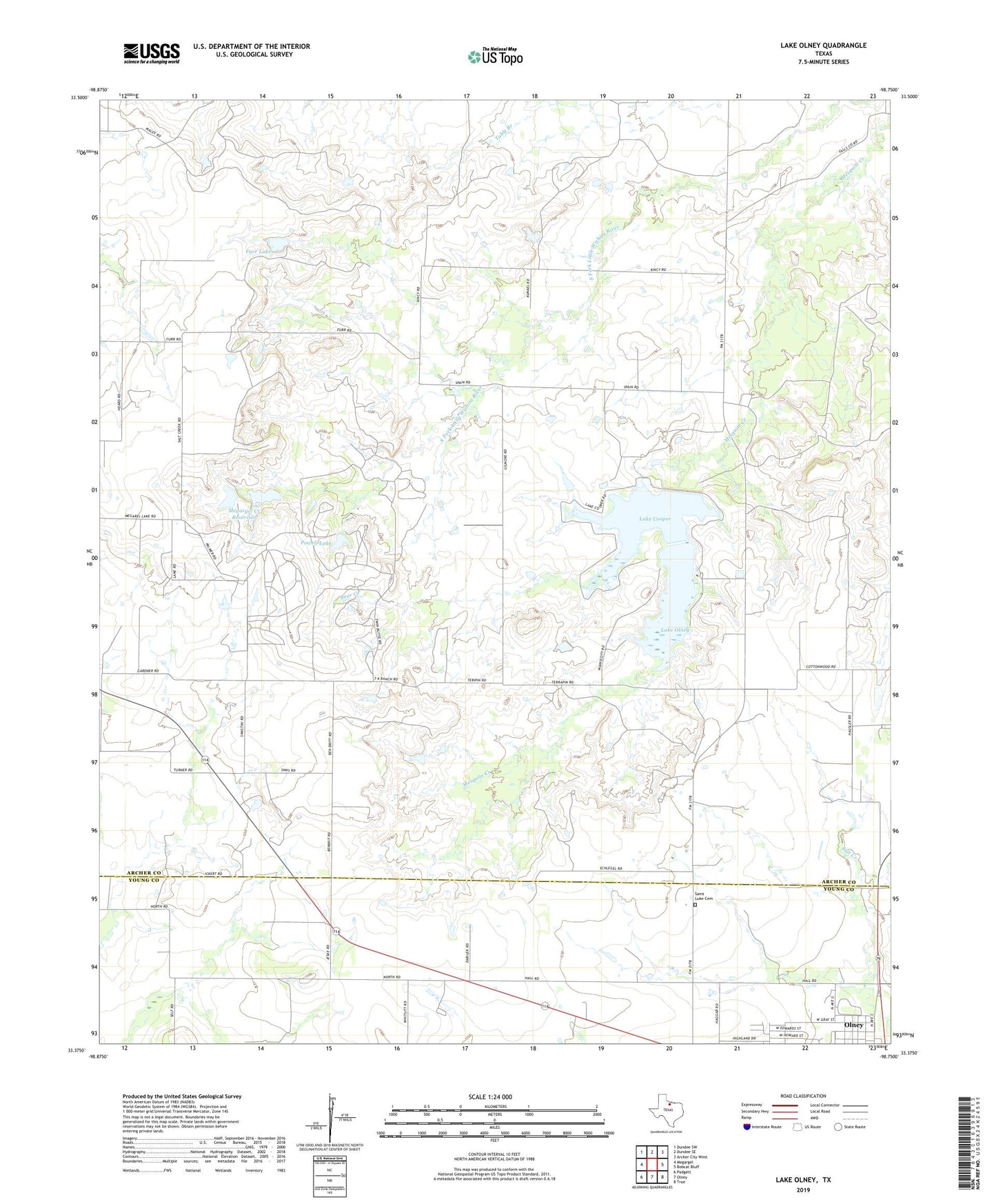
2022 topographic map quadrangle Lake Olney in the state of Texas. Scale: 1:24000. Based on the newly updated USGS 7.5' US Topo map series, this map is in the following counties: Archer, Young. The map contains contour data, water features, and other items you are used to seeing on USGS maps, but also has updated roads and other features. This is the next generation of topographic maps. Printed on high-quality waterproof paper with UV fade-resistant inks.
Quads adjacent to this one:
West: Megargel
Northwest: Dundee SW
North: Dundee SE
Northeast: Archer City West
East: Bobcat Bluff
Southeast: TRUE
South: Olney
Southwest: Padgett
This map covers the same area as the classic USGS quad with code o33098d7.
Contains the following named places: Bear Creek, Furr Lake, Furr Lake Dam, Immanuel Baptist Church, Lake Cooper, Lake Cooper Dam, Lake Cooper Reservoir, Lake Olney, Lake Olney Dam, Lone Oak Community Center, Megargel Creek Dam, Megargel Creek Reservoir, Powell Lake, Powell Lake Dam, Saint Luke Cemetery, Saint Luke Church