MyTopo
Joppa Texas US Topo Map
Couldn't load pickup availability
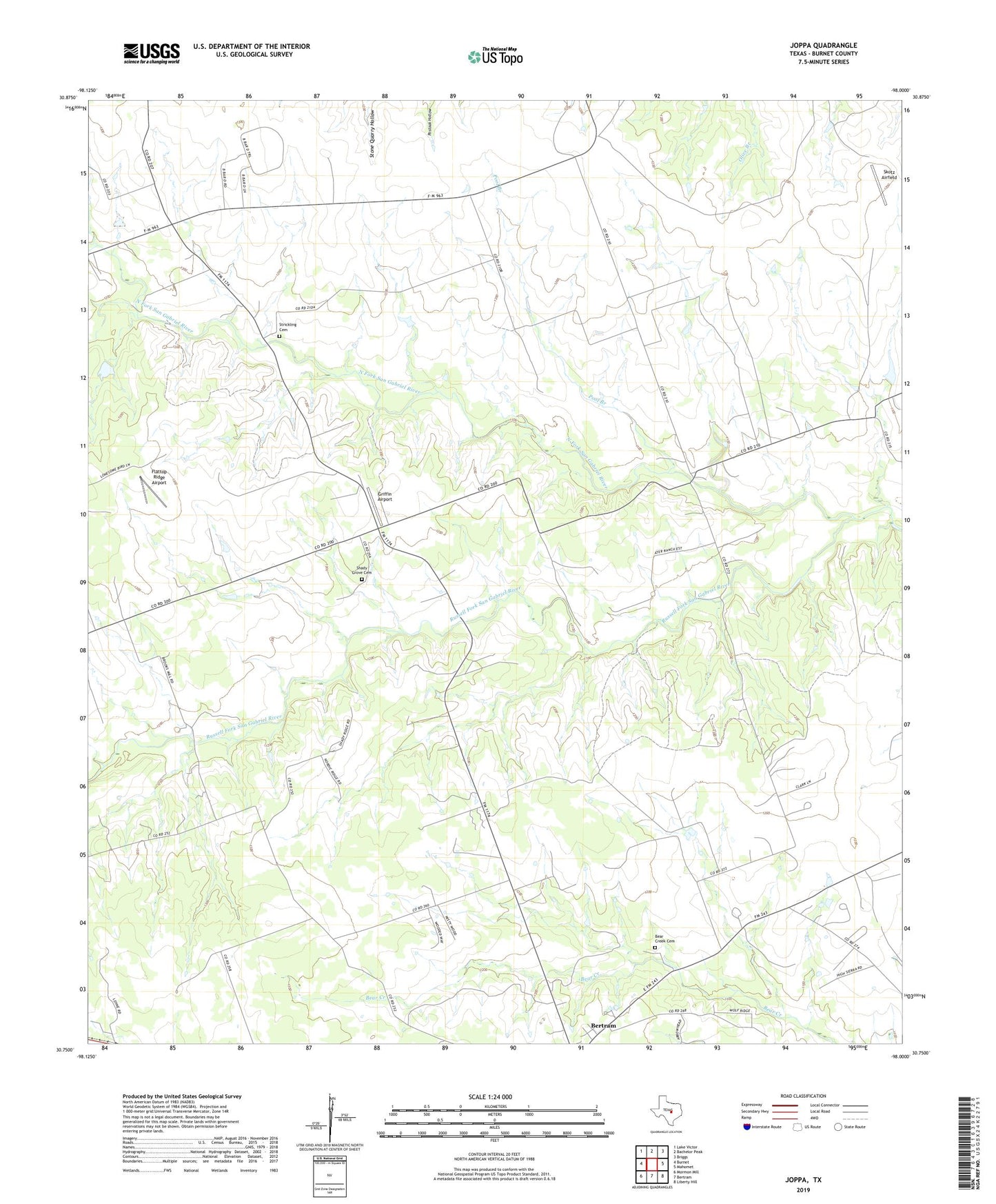
2022 topographic map quadrangle Joppa in the state of Texas. Scale: 1:24000. Based on the newly updated USGS 7.5' US Topo map series, this map is in the following counties: Burnet. The map contains contour data, water features, and other items you are used to seeing on USGS maps, but also has updated roads and other features. This is the next generation of topographic maps. Printed on high-quality waterproof paper with UV fade-resistant inks.
Quads adjacent to this one:
West: Burnet
Northwest: Lake Victor
North: Bachelor Peak
Northeast: Briggs
East: Mahomet
Southeast: Liberty Hill
South: Bertram
Southwest: Mormon Mill
This map covers the same area as the classic USGS quad with code o30098g1.
Contains the following named places: Bear Creek Cemetery, Blacks Fort, Flattop Ridge Airport, Griffin Airport, Joppa, Pool Branch, Russell Fork San Gabriel River, Shady Grove, Shady Grove Cemetery, Skotz Airfield, Strickling Cemetery, ZIP Code: 78605