MyTopo
Lane City SE Texas US Topo Map
Couldn't load pickup availability
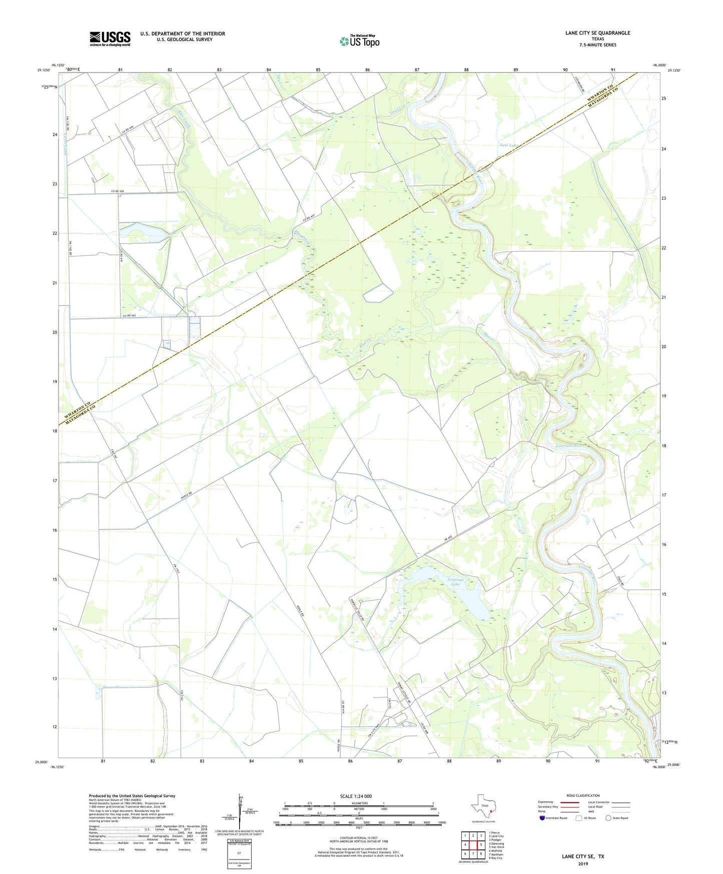
2022 topographic map quadrangle Lane City SE in the state of Texas. Scale: 1:24000. Based on the newly updated USGS 7.5' US Topo map series, this map is in the following counties: Matagorda, Wharton. The map contains contour data, water features, and other items you are used to seeing on USGS maps, but also has updated roads and other features. This is the next generation of topographic maps. Printed on high-quality waterproof paper with UV fade-resistant inks.
Quads adjacent to this one:
West: Danevang
Northwest: Pierce
North: Lane City
Northeast: Pledger
East: Van Vleck
Southeast: Bay City
South: Markham
Southwest: Midfield
This map covers the same area as the classic USGS quad with code o29096a1.
Contains the following named places: Betts Lake, Blue Creek, Dry Creek, East K O School, Jennings Lake, Neal Lake, North Bay City Oil Field, North Markham Oil Field, Silver Lake, Station 24 Heliport, ZIP Code: 77456