MyTopo
Van Vleck Texas US Topo Map
Couldn't load pickup availability
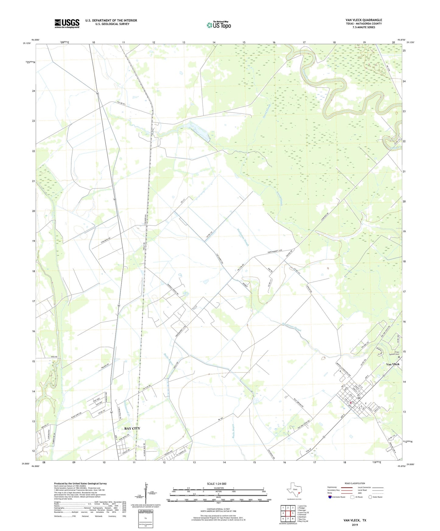
2022 topographic map quadrangle Van Vleck in the state of Texas. Scale: 1:24000. Based on the newly updated USGS 7.5' US Topo map series, this map is in the following counties: Matagorda. The map contains contour data, water features, and other items you are used to seeing on USGS maps, but also has updated roads and other features. This is the next generation of topographic maps. Printed on high-quality waterproof paper with UV fade-resistant inks.
Quads adjacent to this one:
West: Lane City SE
Northwest: Lane City
North: Pledger
Northeast: Danciger
East: Ashwood
Southeast: Bay City NE
South: Bay City
Southwest: Markham
This map covers the same area as the classic USGS quad with code o29095a8.
Contains the following named places: Ag Aviation Airport, Armour Oil Field, Bay City Division, Bay City Oil Field, Camp Pierce, Chalmers, Free System Cemetery, Matagorda County Alternative Education School, McCroskey, O H Herman Middle School, Podo, Roselawn Memorial Park, Van Vleck, Van Vleck Census Designated Place, Van Vleck Elementary School, Van Vleck High School, Van Vleck Intermediate School, Van Vleck Post Office, Van Vleck Volunteer Fire Department, ZIP Code: 77482