MyTopo
Laneville Texas US Topo Map
Couldn't load pickup availability
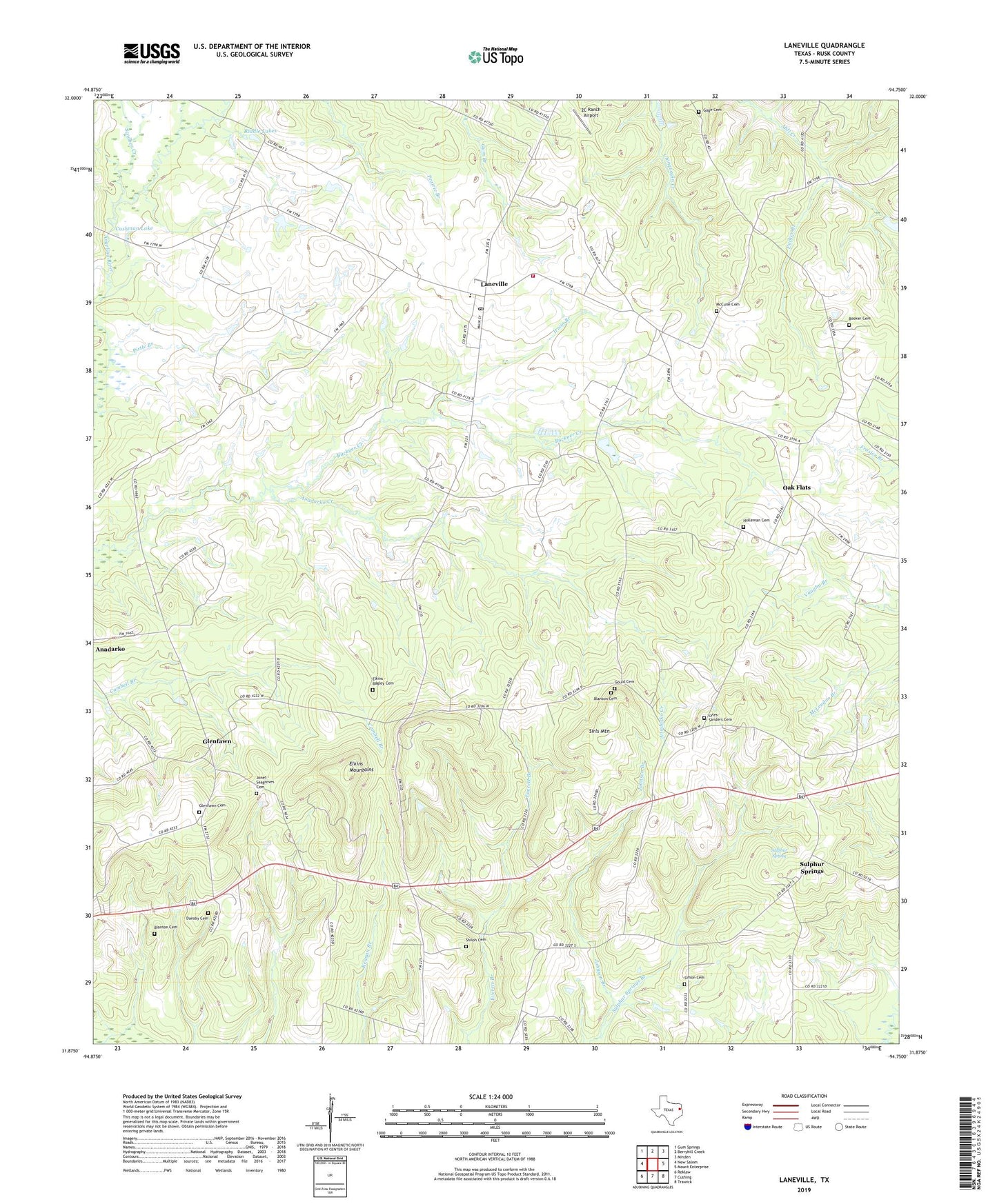
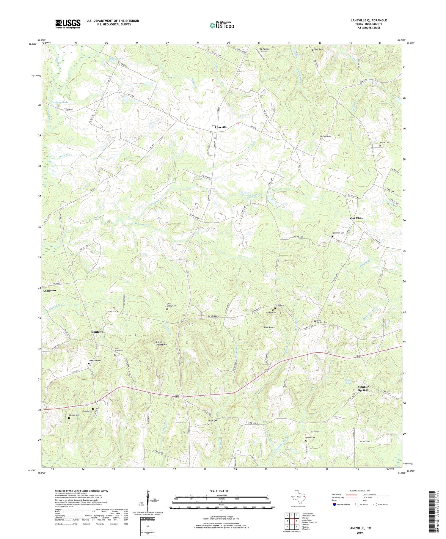
2019 topographic map quadrangle Laneville in the state of Texas. Scale: 1:24000. Based on the newly updated USGS 7.5' US Topo map series, this map is in the following counties: Rusk. The map contains contour data, water features, and other items you are used to seeing on USGS maps, but also has updated roads and other features. This is the next generation of topographic maps. Printed on high-quality waterproof paper with UV fade-resistant inks.
Quads adjacent to this one:
West: New Salem
Northwest: Gum Springs
North: Berryhill Creek
Northeast: Minden
East: Mount Enterprise
Southeast: Trawick
South: Cushing
Southwest: Reklaw
Contains the following named places: 2C Ranch Airport, 75667, Baysinger Cemetery, Blanton Cemetery, Booker Cemetery, Buckner Creek, Cushman Lake, Dansby Cemetery, Elkins - Bagley Cemetery, Elkins Mountains, Freeneytown, Gage Cemetery, Glenfawn, Glenfawn Cemetery, Gould Cemetery, Holleman Cemetery, Hunter Lowry Airport, Irwin Branch, Johnson Branch, Jones - Hogg Cemetery, Jones Lake Dam, Kilgore Public Library, Laneville, Laneville Division, Laneville Post Office, Laneville Volunteer Fire Department, Lyles-Sanders Cemetery, McCune Cemetery, Mount Zion Church, Oak Flats, Parker Branch, Pine Grove Church, Pirtle Branch, Riddle Lakes, Sawmill Branch, Scoober Creek, Shiloh Cemetery, Simon Cemetery, Sirls Mountain, Sulphur Spring, Sulphur Springs, Valley Grove