MyTopo
Gum Springs Texas US Topo Map
Couldn't load pickup availability
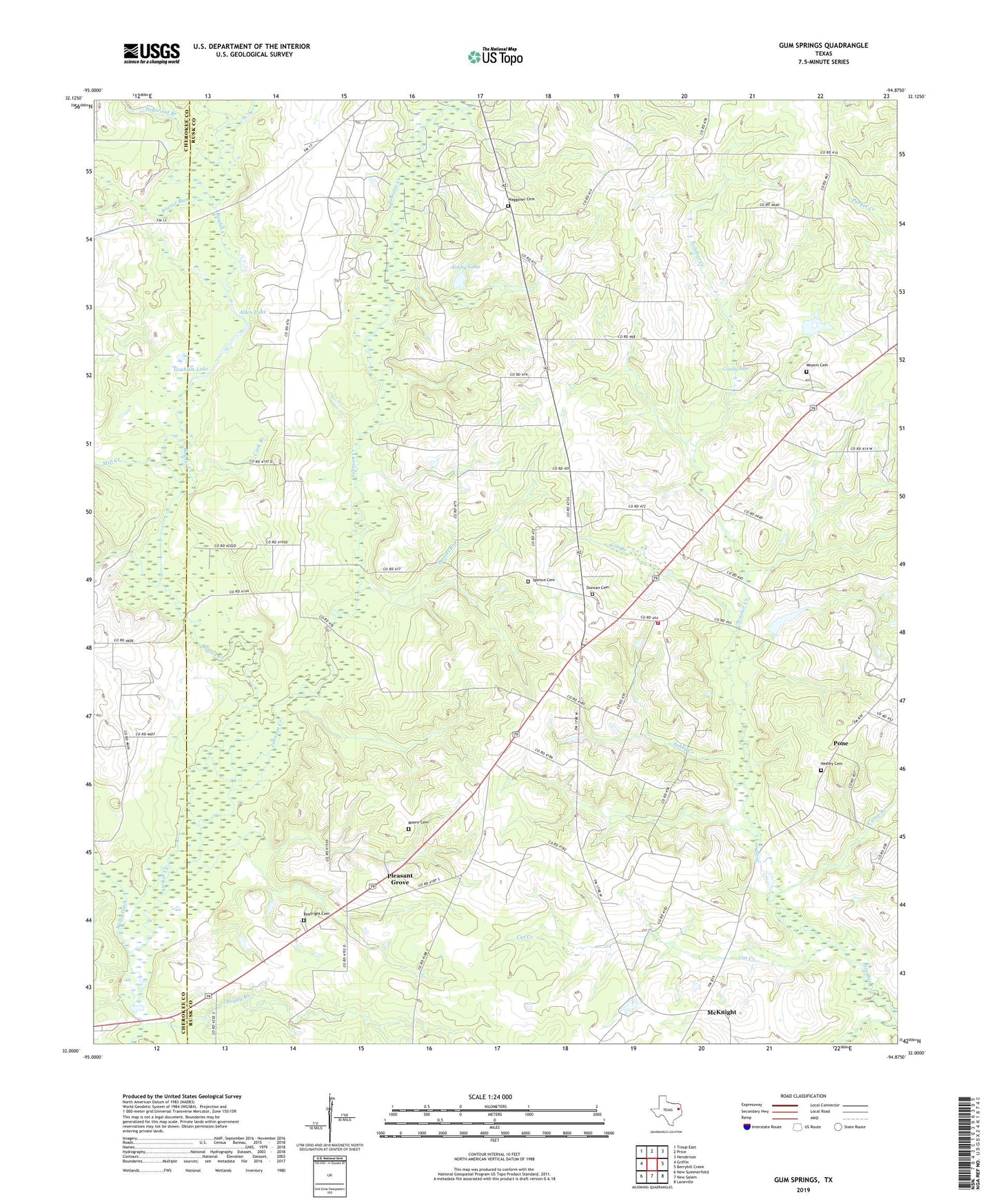
2022 topographic map quadrangle Gum Springs in the state of Texas. Scale: 1:24000. Based on the newly updated USGS 7.5' US Topo map series, this map is in the following counties: Rusk, Cherokee. The map contains contour data, water features, and other items you are used to seeing on USGS maps, but also has updated roads and other features. This is the next generation of topographic maps. Printed on high-quality waterproof paper with UV fade-resistant inks.
Quads adjacent to this one:
West: Griffin
Northwest: Troup East
North: Price
Northeast: Henderson
East: Berryhill Creek
Southeast: Laneville
South: New Salem
Southwest: New Summerfield
This map covers the same area as the classic USGS quad with code o32094a8.
Contains the following named places: Allen Lake, Ashby Creek, Ashby Lake, Beaver Run, Big Springs, Boggy Branch, Bowles Creek, Camp Branch, Carlisle Volunteer Fire Department Station 2, Cat Creek, Cook Branch, County Lake, Daniel Branch, Dogwood Branch, Duncan Cemetery, Gin Branch, Good Springs, Graham Lake, Gum Springs, Johnson Creek, Macedonia Church, McKnight, Mill Creek, Moore Cemetery, Moyers Cemetery, Neeley Cemetery, Pleasant Grove, Pleasant Grove Cemetery, Pone, Price-Turnertown Division, Sardis Church, Spence Cemetery, Stringtown, Turner Lake, Waggoner Cemetery