MyTopo
Las Conchas Texas US Topo Map
Couldn't load pickup availability
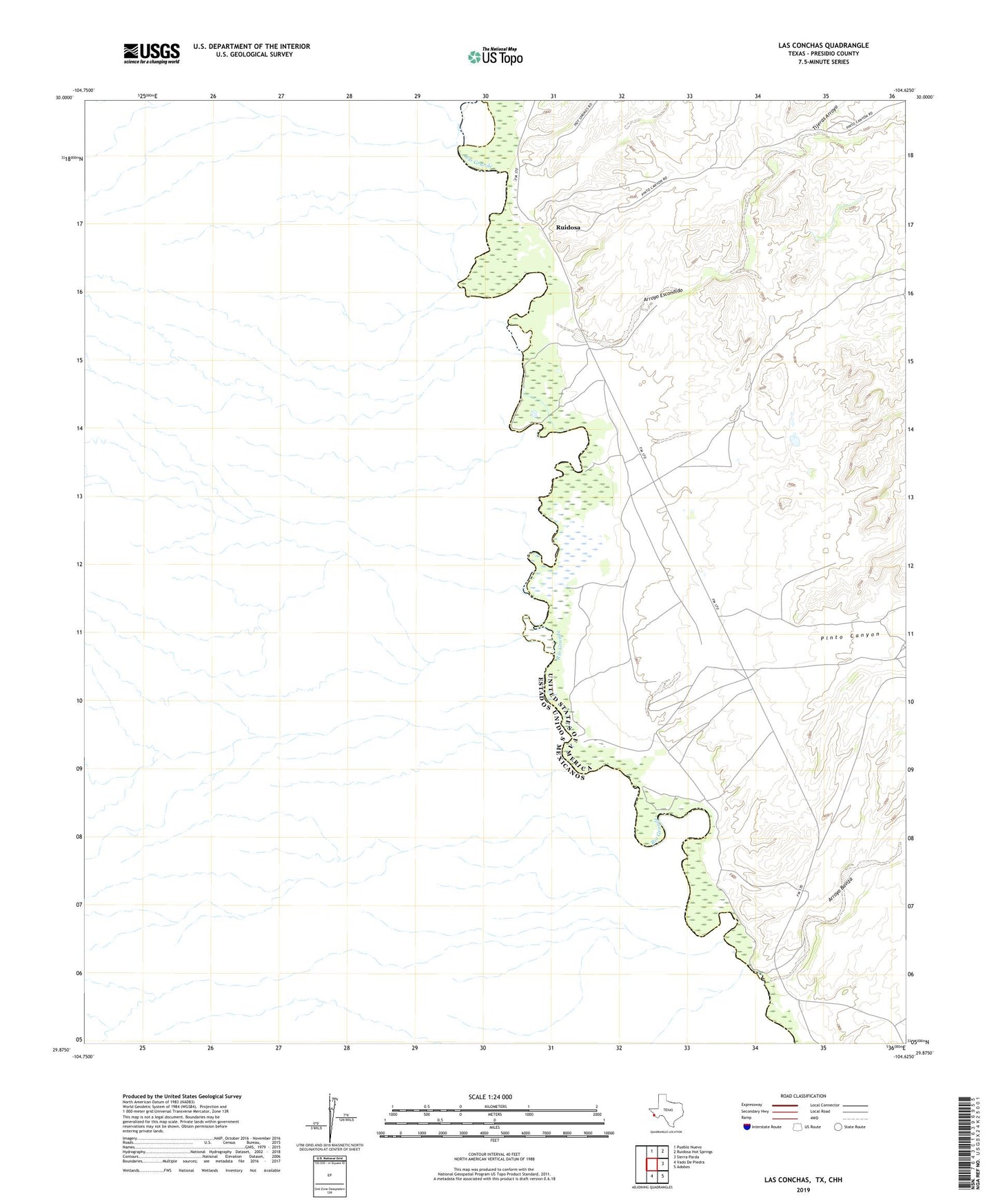
2022 topographic map quadrangle Las Conchas in the state of Texas. Scale: 1:24000. Based on the newly updated USGS 7.5' US Topo map series, this map is in the following counties: Presidio. The map contains contour data, water features, and other items you are used to seeing on USGS maps, but also has updated roads and other features. This is the next generation of topographic maps. Printed on high-quality waterproof paper with UV fade-resistant inks.
Quads adjacent to this one:
North: Pueblo Nuevo
Northeast: Ruidosa Hot Springs
East: Sierra Parda
Southeast: Adobes
South: Vado De Piedra
This map covers the same area as the classic USGS quad with code o29104h6.
Contains the following named places: Arroyo Baviza, Arroyo Escondido, La Presa Crossing, Pinto Canyon, Ruidosa, Ruidosa School, Sacred Heart Church, Sparks Crossing, Tijeras Arroyo