MyTopo
Riviera Beach NE Texas US Topo Map
Couldn't load pickup availability
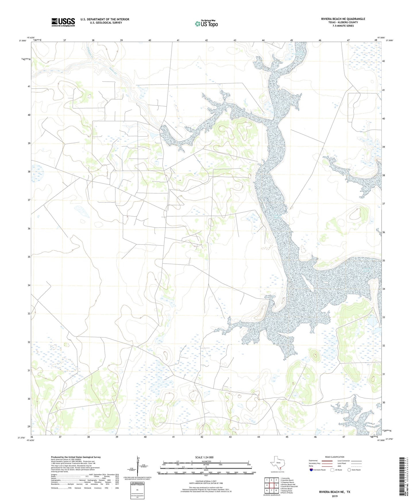
2022 topographic map quadrangle Riviera Beach NE in the state of Texas. Scale: 1:24000. Based on the newly updated USGS 7.5' US Topo map series, this map is in the following counties: Kleberg. The map contains contour data, water features, and other items you are used to seeing on USGS maps, but also has updated roads and other features. This is the next generation of topographic maps. Printed on high-quality waterproof paper with UV fade-resistant inks.
Quads adjacent to this one:
West: Riviera Beach NW
Northwest: Concordia
North: Laureles Ranch
Northeast: Chapman Ranch
East: South Bird Island NW
Southeast: Point of Rocks
South: Kleberg Point
Southwest: Riviera Beach
This map covers the same area as the classic USGS quad with code o27097d5.
Contains the following named places: Burro Well, Cayo de Hinoso, Cayo del Mazon, Chiltipin Creek, Esquina Well, Field Fifteen Well, Field Fourteen Well, Guayacan Well, Hinojoseno Artesian Well, Huisache Well, Jaboncillos Ranch, Kingsville Division, Little Tule Lake, Noria Maria Well, Petronila Creek, Portales Verde Well, Tunas Creek, Zacahuistle Well