MyTopo
South Bird Island NW Texas US Topo Map
Couldn't load pickup availability
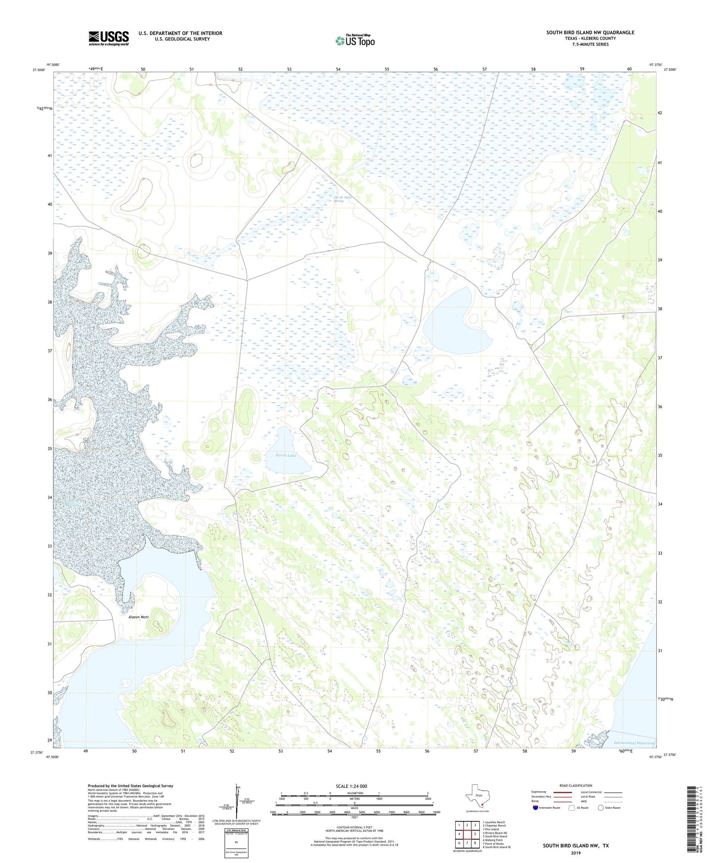
2022 topographic map quadrangle South Bird Island NW in the state of Texas. Scale: 1:24000. Based on the newly updated USGS 7.5' US Topo map series, this map is in the following counties: Kleberg. The map contains contour data, water features, and other items you are used to seeing on USGS maps, but also has updated roads and other features. This is the next generation of topographic maps. Printed on high-quality waterproof paper with UV fade-resistant inks.
Quads adjacent to this one:
West: Riviera Beach NE
Northwest: Laureles Ranch
North: Chapman Ranch
Northeast: Pita Island
East: South Bird Island
Southeast: South Bird Island SE
South: Point of Rocks
Southwest: Kleberg Point
This map covers the same area as the classic USGS quad with code o27097d4.
Contains the following named places: Alazan Artesian Well, Alazan Mott, Altos Prietos Artesian Well, Auras Well, Becerra Well, Cabeza Artesian Well, Esperanza Artesian Well, Estrella Well, Galixtro Well, Mateo Well, Mesquite Well, Noche Bueno, Ojo de Agua Spring, Ojo de Angua, Palomas Well, Parra Lake, Patricia Artesian Well, Perra Artesian Well, Sordo Well, Tanques de Luis Well