MyTopo
Metcalf Gap Texas US Topo Map
Couldn't load pickup availability
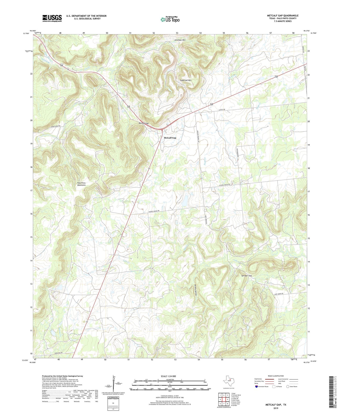
2019 topographic map quadrangle Metcalf Gap in the state of Texas. Scale: 1:24000. Based on the newly updated USGS 7.5' US Topo map series, this map is in the following counties: Palo Pinto. The map contains contour data, water features, and other items you are used to seeing on USGS maps, but also has updated roads and other features. This is the next generation of topographic maps. Printed on high-quality waterproof paper with UV fade-resistant inks.
Quads adjacent to this one:
West: Caddo NE
Northwest: Brad
North: Fortune Bend
Northeast: Palo Pinto
East: Lone Camp
Southeast: Gordon
South: Strawn East
Southwest: Strawn West
Contains the following named places: Antelope Mountain, Brushy Hollow, Dodson Prairie Church, Dodson Prairie Community Hall, Hodgkins Lake, Hodgkins Lake Dam, Little Ioni Creek, Massey Branch, Metcalf Gap, Metcalf Gap Oil Field, Springer Gap, Strawn-Gordon Division, Sugarloaf Mountain, ZIP Code: 76475