MyTopo
Meyersville Texas US Topo Map
Couldn't load pickup availability
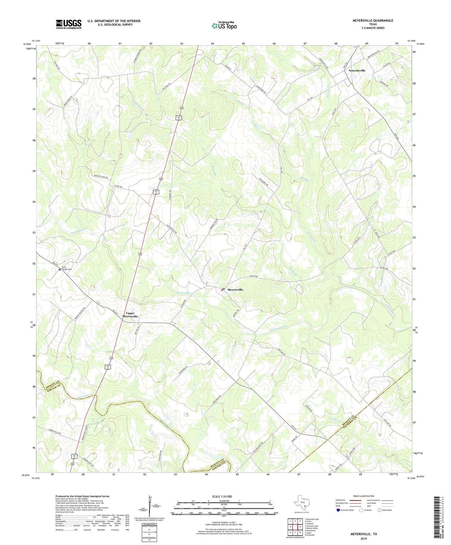
2022 topographic map quadrangle Meyersville in the state of Texas. Scale: 1:24000. Based on the newly updated USGS 7.5' US Topo map series, this map is in the following counties: DeWitt, Goliad, Victoria. The map contains contour data, water features, and other items you are used to seeing on USGS maps, but also has updated roads and other features. This is the next generation of topographic maps. Printed on high-quality waterproof paper with UV fade-resistant inks.
Quads adjacent to this one:
West: Yorktown East
Northwest: Blackwell Lake
North: Cuero
Northeast: Verhelle
East: Mission Valley
Southeast: Schroeder
South: Ander
Southwest: Weesatche
This map covers the same area as the classic USGS quad with code o28097h3.
Contains the following named places: Arneckeville, Arneckeville Gas Field, Boggy Branch, Cottonwood Creek Oil Field, De Witt School, Fivemile Creek, Golly, Hog Branch, Holly Oil Field, Hoosier Creek, Meyersville, Meyersville Elementary School, Meyersville Gas Field, Meyersville Post Office, Meyersville Volunteer Fire Department, Saint Johns Church, Saint Joseph Cemetery, Saint Peter and Pauls Church, Upper Meyersville, ZIP Code: 77974