MyTopo
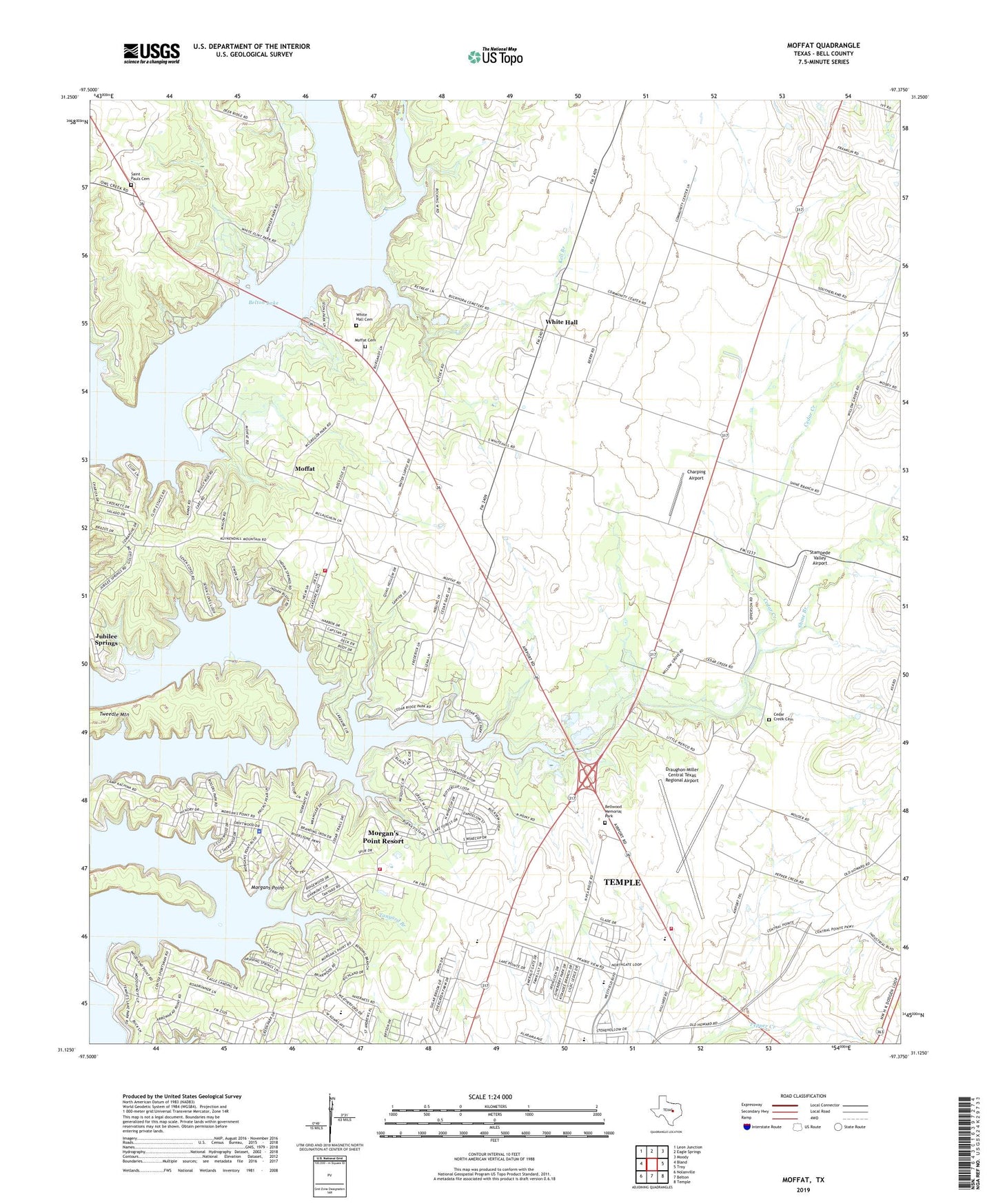
Moffat Texas US Topo Map
Couldn't load pickup availability
2019 topographic map quadrangle Moffat in the state of Texas. Scale: 1:24000. Based on the newly updated USGS 7.5' US Topo map series, this map is in the following counties: Bell. The map contains contour data, water features, and other items you are used to seeing on USGS maps, but also has updated roads and other features. This is the next generation of topographic maps. Printed on high-quality waterproof paper with UV fade-resistant inks.
Quads adjacent to this one:
West: Bland
Northwest: Leon Junction
North: Eagle Springs
Northeast: Moody
East: Troy
Southeast: Temple
South: Belton
Southwest: Nolanville
Contains the following named places: Bell County Sportsmans Club, Bellwood Memorial Park, Camp Kachina, Cedar Creek, Cedar Creek Cemetery, Cedar Creek Church, Cedar Creek Wildlife Management Area, Cedar Ridge Park, Charping Airport, City of Morgan's Point Resort, Draughon-Miller Central Texas Regional Airport, Fellowship Baptist Church, Hidden Canyon Park, Jubilee Springs, Kell Branch, Kell Branch Church, Lakeview Church, Lakewood Elementary School, Leona Park, Little Peach Airport, McGregor Park, Metheglin Creek, Moffat, Moffat Cemetery, Moffat School, Moffat Volunteer Fire Department, Morgans Point, Morgans Point Resort, Morgan's Point Resort Police Department, Morgans Point Resort Volunteer Fire Department, Northwest Bell Division, Optimist Park, Rogers Park, Saint Pauls Cemetery, Shine Branch, Stampede Creek, Stampede Valley Airport, Sunset Speedway, Tanyard Branch, Temple Army Air Field, Temples Lake Park, Tweedle Mountain, White Flint Park, White Flint Wildlife Management Area, White Hall, White Hall Cemetery, Winkler Park, Woodland