MyTopo
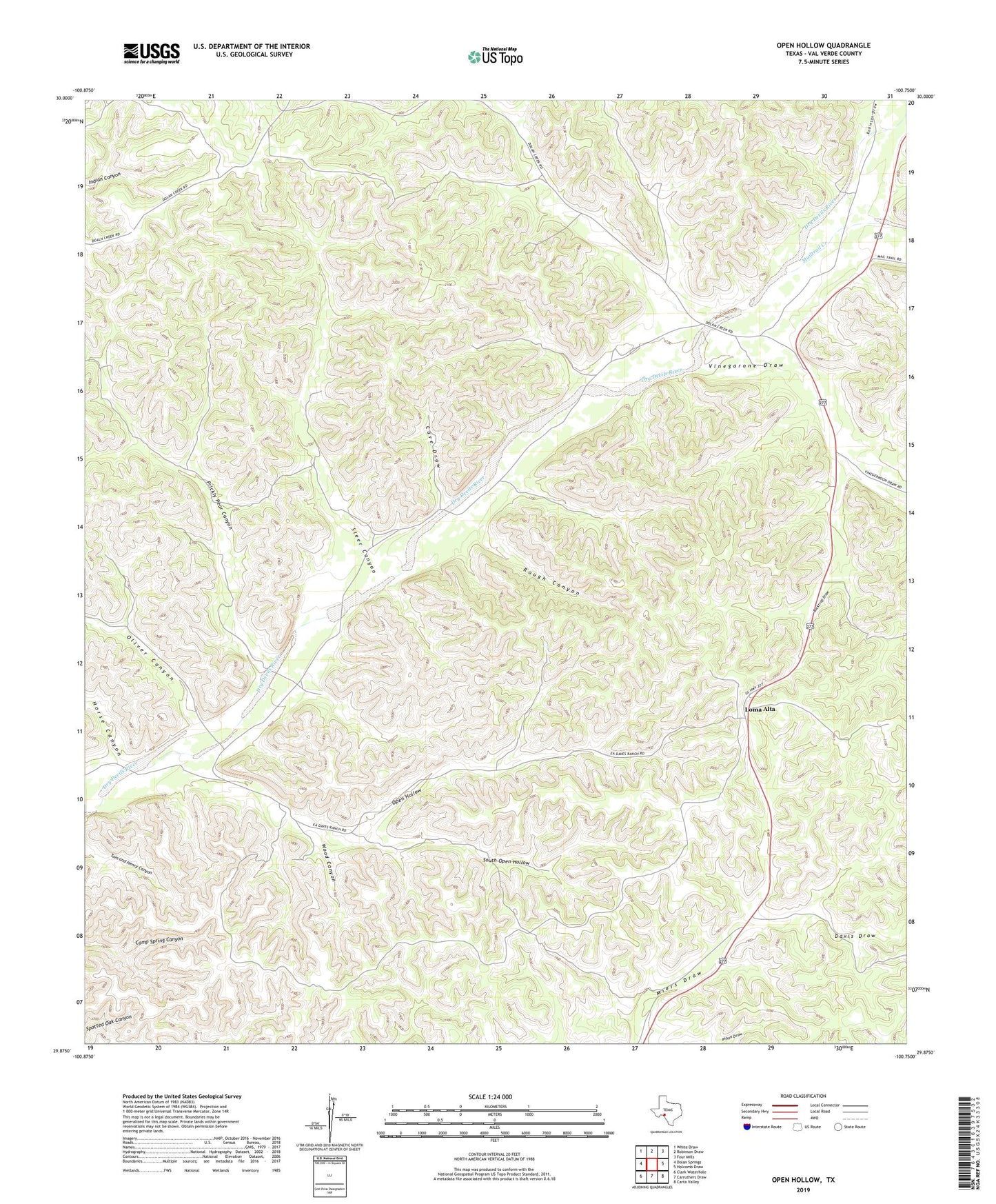
Open Hollow Texas US Topo Map
Couldn't load pickup availability
2022 topographic map quadrangle Open Hollow in the state of Texas. Scale: 1:24000. Based on the newly updated USGS 7.5' US Topo map series, this map is in the following counties: Val Verde. The map contains contour data, water features, and other items you are used to seeing on USGS maps, but also has updated roads and other features. This is the next generation of topographic maps. Printed on high-quality waterproof paper with UV fade-resistant inks.
Quads adjacent to this one:
West: Dolan Springs
Northwest: White Draw
North: Robinson Draw
Northeast: Four Mills
East: Holcomb Draw
Southeast: Carta Valley
South: Carruthers Draw
Southwest: Clark Waterhole
This map covers the same area as the classic USGS quad with code o29100h7.
Contains the following named places: Bucktrap Draw, Cave Draw, Davis Draw, Flying D Ranch Airport, Horse Canyon, Loma Alta, Mailtrail Creek, Oliver Canyon, Open Hollow, Prickly Pear Canyon, Robinson Draw, Rough Canyon, South Open Hollow, Steer Canyon, Vinegarone, Vinegarone Draw, Wood Canyon