MyTopo
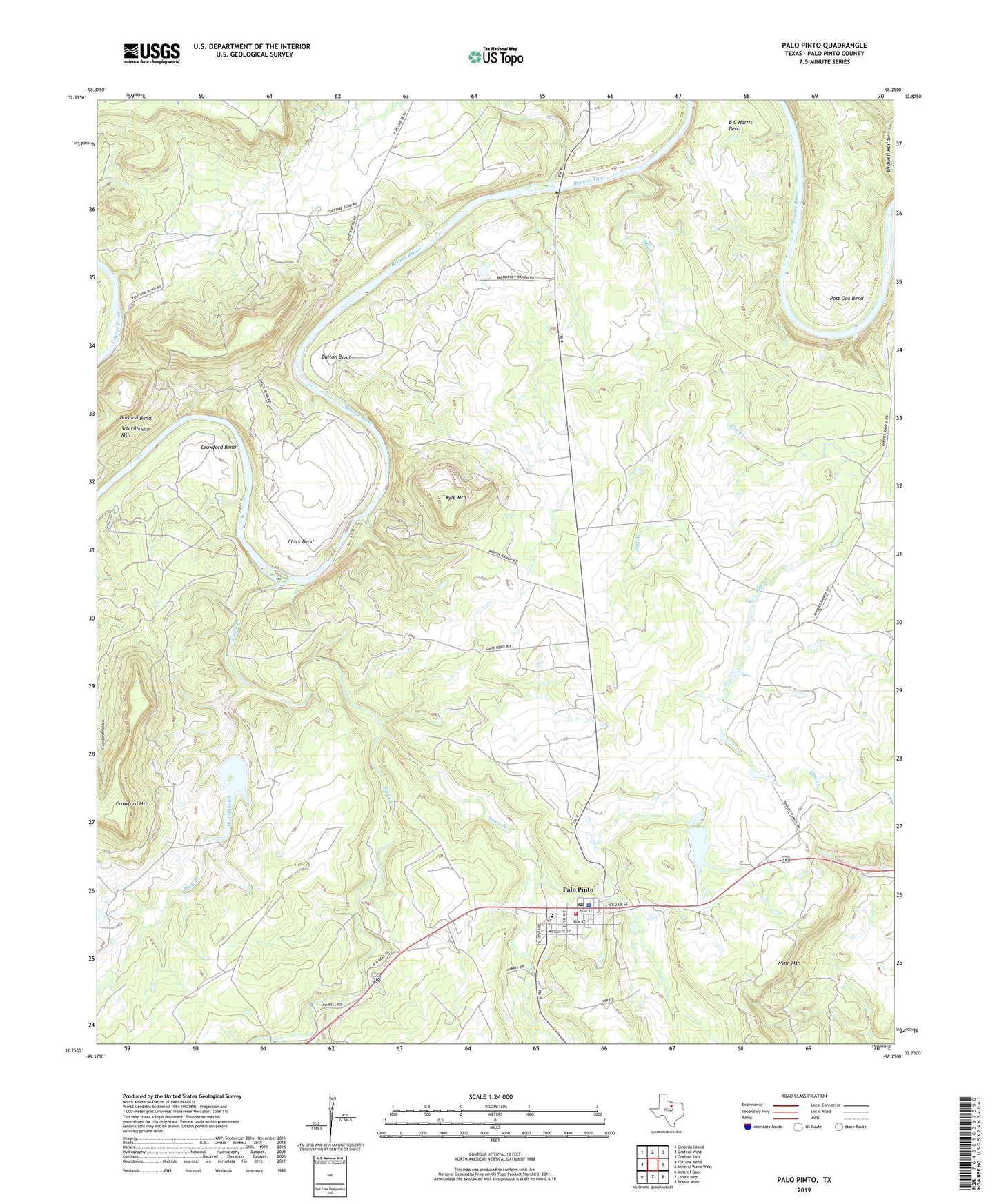
Palo Pinto Texas US Topo Map
Couldn't load pickup availability
2019 topographic map quadrangle Palo Pinto in the state of Texas. Scale: 1:24000. Based on the newly updated USGS 7.5' US Topo map series, this map is in the following counties: Palo Pinto. The map contains contour data, water features, and other items you are used to seeing on USGS maps, but also has updated roads and other features. This is the next generation of topographic maps. Printed on high-quality waterproof paper with UV fade-resistant inks.
Quads adjacent to this one:
West: Fortune Bend
Northwest: Costello Island
North: Graford West
Northeast: Graford East
East: Mineral Wells West
Southeast: Brazos West
South: Lone Camp
Southwest: Metcalf Gap
Contains the following named places: B C Harris Bend, Chick Bend, Costello Lake, Costello Lake Dam, Crawford Bend, Crawford Mountain, Dalton Bend, Dark Valley Creek, Eagle Creek, Elm Creek, Kyle Mountain, Little Keechi Creek, McMurrey Lake, McMurrey Lake Dam, Mill Branch, Palo Pinto, Palo Pinto Census Designated Place, Palo Pinto County, Palo Pinto County Constable's Office Precinct 3, Palo Pinto County Constable's Office Precinct 4, Palo Pinto County Jail, Palo Pinto County Old Jail Museum, Palo Pinto County Sheriff's Office, Palo Pinto Elementary School, Palo Pinto Emergency Medical, Palo Pinto Fire Department, Palo Pinto Post Office, Post Oak Bend, Rocky Prairie, Town Branch, Wolf Branch, Worth Ranch, Wynn Mountain, ZIP Code: 76484