
MyTopo
Placid Texas US Topo Map
Couldn't load pickup availability
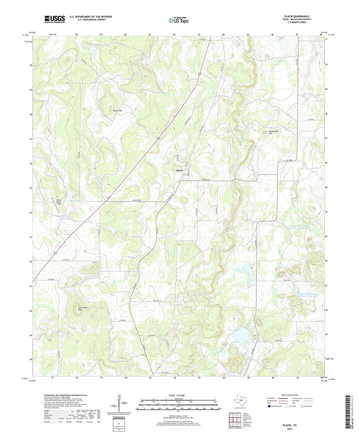
2019 topographic map quadrangle Placid in the state of Texas. Scale: 1:24000. Based on the newly updated USGS 7.5' US Topo map series, this map is in the following counties: McCulloch. The map contains contour data, water features, and other items you are used to seeing on USGS maps, but also has updated roads and other features. This is the next generation of topographic maps. Printed on high-quality waterproof paper with UV fade-resistant inks.
Quads adjacent to this one:
West: Bluff Creek
Northwest: Whon
North: Mercury
Northeast: Elm Grove
East: Hall
Southeast: Lost Creek
South: Rochelle
Southwest: Brady North
Contains the following named places: Cedar Creek Tank, Cedar Creek Tank Dam, Corn Creek Hills, Curtis Ranch Field, Deep Creek Watershed Reservoir Number Four, Deep Creek Watershed Reservoir Number Three, Deep Creek Watershed Reservoir Number Two, Herberg Lake, Packsaddle Hill, Placid, Rochelle Division, Round Mountain, Soil Conservation Service Site 1 Dam, Soil Conservation Service Site 2 Dam, Soil Conservation Service Site 2 Reservoir, Soil Conservation Service Site 3 Dam, Soil Conservation Service Site 3 Reservoir, Soil Conservation Service Site 4 Dam, Soil Conservation Service Site 4 Reservoir, Z Ranch Lake, Z Ranch Lake Dam, ZIP Code: 76872


