MyTopo
Whon Texas US Topo Map
Couldn't load pickup availability
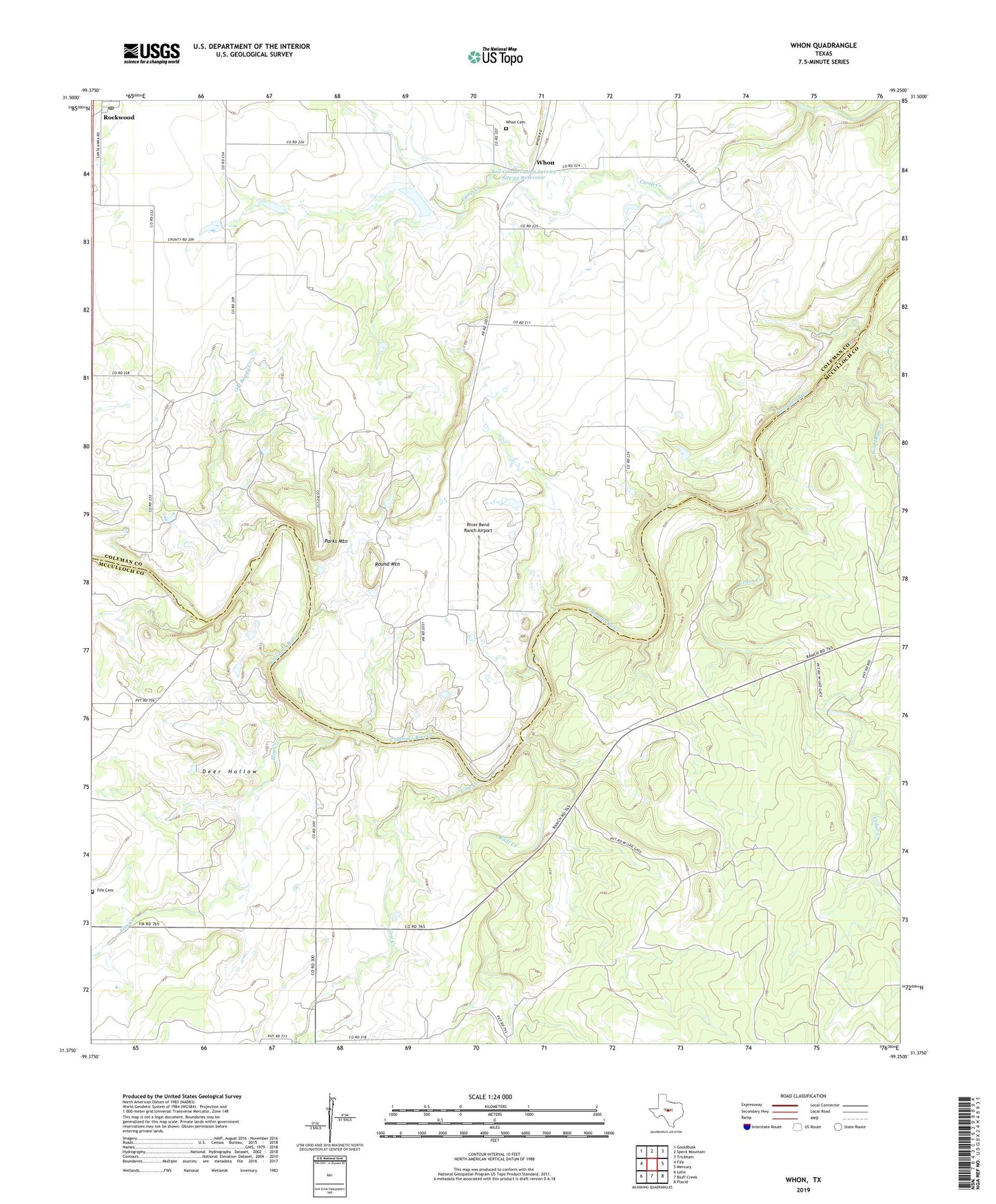
2022 topographic map quadrangle Whon in the state of Texas. Scale: 1:24000. Based on the newly updated USGS 7.5' US Topo map series, this map is in the following counties: Coleman, McCulloch. The map contains contour data, water features, and other items you are used to seeing on USGS maps, but also has updated roads and other features. This is the next generation of topographic maps. Printed on high-quality waterproof paper with UV fade-resistant inks.
Quads adjacent to this one:
West: Fife
Northwest: Gouldbusk
North: Speck Mountain
Northeast: Trickham
East: Mercury
Southeast: Placid
South: Bluff Creek
Southwest: Lohn
This map covers the same area as the classic USGS quad with code o31099d3.
Contains the following named places: Bluff Creek, Camp Creek, Cedar Creek, Cow Creek, Deer Hollow, Elm Creek, Fife Cemetery, Knight Crossing, Military Crossing, Mitchell Crossing, Old Boggy Creek, Parks Mountain, River Bend Ranch Airport, Rockwood Post Office, Round Mountain, Soil Conservation Service Site 22 Dam, Soil Conservation Service Site 22 Reservoir, State of Texas, Tom Dean Creek, Walker Crossing, Whon, Whon Cemetery