MyTopo
Hall Texas US Topo Map
Couldn't load pickup availability
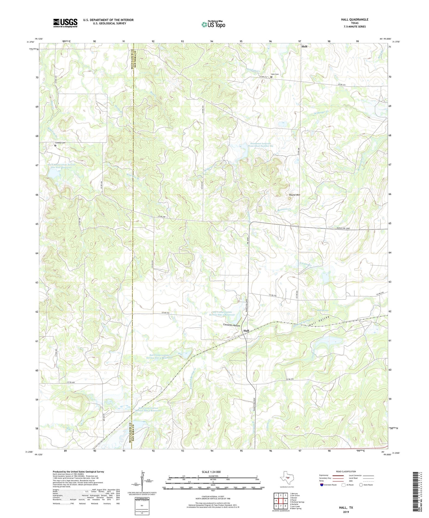
2022 topographic map quadrangle Hall in the state of Texas. Scale: 1:24000. Based on the newly updated USGS 7.5' US Topo map series, this map is in the following counties: San Saba, McCulloch. The map contains contour data, water features, and other items you are used to seeing on USGS maps, but also has updated roads and other features. This is the next generation of topographic maps. Printed on high-quality waterproof paper with UV fade-resistant inks.
Quads adjacent to this one:
West: Placid
Northwest: Mercury
North: Elm Grove
Northeast: Bowser
East: Richland Springs
Southeast: Baker Spring
South: Lost Creek
Southwest: Rochelle
This map covers the same area as the classic USGS quad with code o31099c1.
Contains the following named places: Clements Hollow, Cowboy Cemetery, East Goens Creek, Goens Creek, Hall, Hall Springs, Hall Valley, Hog Creek, Holt, Holt Cemetery, North Goens Creek, Round Mountain, Selman, Soil Conservation Service Site 2 Dam, Soil Conservation Service Site 2 Reservoir, Soil Conservation Service Site 3 Dam, Soil Conservation Service Site 3 Reservoir, Soil Conservation Service Site 4 Dam, Soil Conservation Service Site 4 Reservoir, Soil Conservation Service Site 5 Dam, Soil Conservation Service Site 5 Reservoir, Soil Conservation Service Site 6 Dam, Soil Conservation Service Site 6 Reservoir, Soil Conservation Service Site 7 Dam, Soil Conservation Service Site 7 Reservoir, Soil Conservation Service Site Five Reservoir, Southeast Laterals Watershed Number Six, West Goens Creek, Wild Cow Branch