MyTopo
Mercury Texas US Topo Map
Couldn't load pickup availability
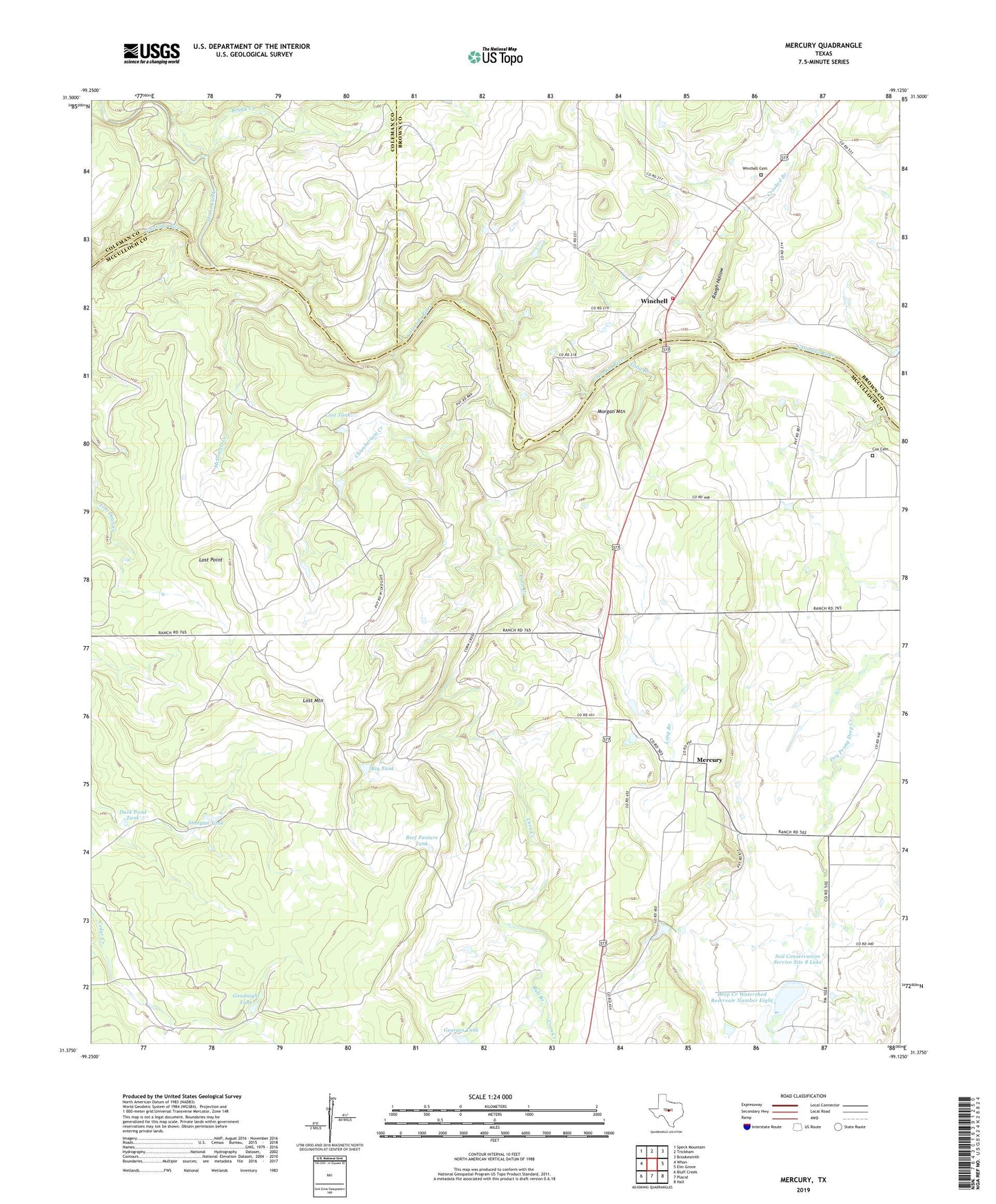
2022 topographic map quadrangle Mercury in the state of Texas. Scale: 1:24000. Based on the newly updated USGS 7.5' US Topo map series, this map is in the following counties: McCulloch, Brown, Coleman. The map contains contour data, water features, and other items you are used to seeing on USGS maps, but also has updated roads and other features. This is the next generation of topographic maps. Printed on high-quality waterproof paper with UV fade-resistant inks.
Quads adjacent to this one:
West: Whon
Northwest: Speck Mountain
North: Trickham
Northeast: Brookesmith
East: Elm Grove
Southeast: Hall
South: Placid
Southwest: Bluff Creek
This map covers the same area as the classic USGS quad with code o31099d2.
Contains the following named places: Beef Pasture Tank, Big Tank, Boggy Creek, Bucy Number One Tank, Bull Branch, Chamberlain Creek, Corn Creek, Cox Cemetery, Crooked Branch, Deep Creek Watershed Reservoir Number Eight, Duck Pond Tank, East Fork Cedar Creek, Georges Tank, Goodnight Tank, High Lonesome Windmill, Home Creek, Long Branch, Lost Mountain, Lost Point, Lost Tank, McDowell Creek, Mercury, Morgan Mountain, Rough Hollow, Shotgun Tank, Soil Conservation Service Site 8 Dam, Soil Conservation Service Site 8 Lake, Winchell, Winchell Cemetery, Winchell Volunteer Fire Department