MyTopo
Elm Grove Texas US Topo Map
Couldn't load pickup availability
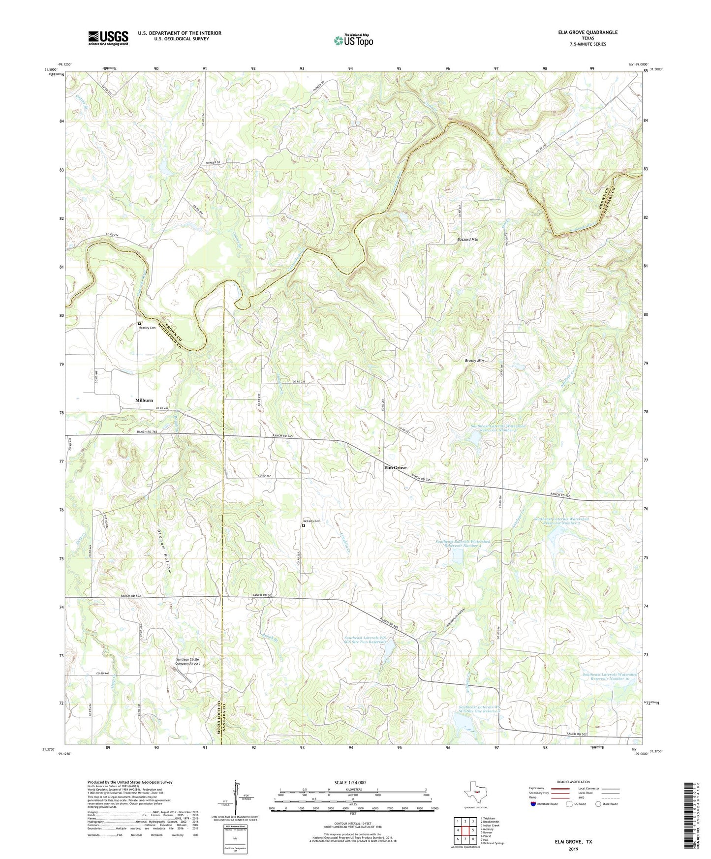
2022 topographic map quadrangle Elm Grove in the state of Texas. Scale: 1:24000. Based on the newly updated USGS 7.5' US Topo map series, this map is in the following counties: San Saba, Brown, McCulloch. The map contains contour data, water features, and other items you are used to seeing on USGS maps, but also has updated roads and other features. This is the next generation of topographic maps. Printed on high-quality waterproof paper with UV fade-resistant inks.
Quads adjacent to this one:
West: Mercury
Northwest: Trickham
North: Brookesmith
Northeast: Indian Creek
East: Bowser
Southeast: Richland Springs
South: Hall
Southwest: Placid
This map covers the same area as the classic USGS quad with code o31099d1.
Contains the following named places: Beasley Cemetery, Beasley Crossing, Brushy Mountain, Buzzard Mountain, Chamberlain Hollow, Clear Creek, Conner Branch, Deep Creek, Dry Prong Deep Creek, Elm Creek, Elm Grove, Elm Grove Church, Elm Grove Community Center, Holt Church, Indian Creek, Keys Crossing, Limekiln Creek, McCarty Cemetery, Milburn, Oldham Hollow, Rough Branch, Santiago Cattle Company Airport, Soil Conservation Service Site 1 Dam, Soil Conservation Service Site 10 Dam, Soil Conservation Service Site 10 Reservoir, Soil Conservation Service Site 2 Dam, Soil Conservation Service Site 3 Dam, Soil Conservation Service Site 3 Reservoir, Soil Conservation Service Site 4 Dam, Soil Conservation Service Site 4 Reservoir, Soil Conservation Service Site 5 Dam, Soil Conservation Service Site 5 Reservoir, Southeast Laterals Watershed Reservoir Number 10, Southeast Laterals Watershed Reservoir Number 3, Southeast Laterals Watershed Reservoir Number 4, Southeast Laterals Watershed Reservoir Number 5, Southeast Laterals WS SCS Site One Reservoir, Southeast Laterals WS SCS Site Two Reservoir, Spring Branch