MyTopo
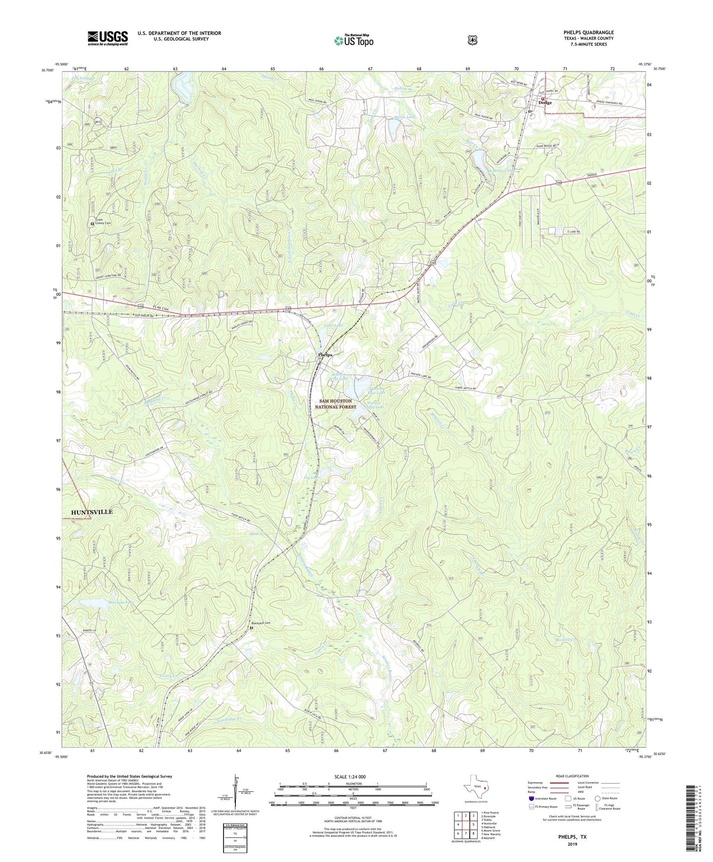
Phelps Texas US Topo Map
Couldn't load pickup availability
Also explore the Phelps Forest Service Topo of this same quad for updated USFS data
2022 topographic map quadrangle Phelps in the state of Texas. Scale: 1:24000. Based on the newly updated USGS 7.5' US Topo map series, this map is in the following counties: Walker. The map contains contour data, water features, and other items you are used to seeing on USGS maps, but also has updated roads and other features. This is the next generation of topographic maps. Printed on high-quality waterproof paper with UV fade-resistant inks.
Quads adjacent to this one:
West: Huntsville
Northwest: Pine Prairie
North: Riverside
Northeast: Staley
East: Oakhurst
Southeast: Maynard
South: New Waverly
Southwest: Moore Grove
This map covers the same area as the classic USGS quad with code o30095f4.
Contains the following named places: Blackjack Cemetery, Burt Creek, Cabin Creek, Campground Church, Caney Creek, Dodge, Dodge Lookout, Dodge Post Office, Dodge Volunteer Fire Department, East Fork Harmon Creek, Elder Creek, Everlena Church, Ford Branch, Four Notch Lookout, Grant Colony Cemetery, Green Loop Trail, Harmony, Hatchery Lake, Hatchery Lake Dam, Joy Lake, Lone Star Trail, Maria Lake, Maria Lake Dam, Mays Creek, McMillian Lake, McMillian Lake Dam, Mitcham Lake, Mitcham Lake Dam, Morian-Sam Houston Oil Field, Mount Morian, New Zion Church, Phelps, Phelps Creek, Pine Valley, Robins Creek, Shepherd Creek, Shiloh Church, Thickett Branch, Tillie Lake, Tillie Lake Dam, Watson East Dam, Watson East Lake, Watson South Dam, Watson South Lake, Watson West Dam, Watson West Lake, Wayne Creek