MyTopo
Rowena Texas US Topo Map
Couldn't load pickup availability
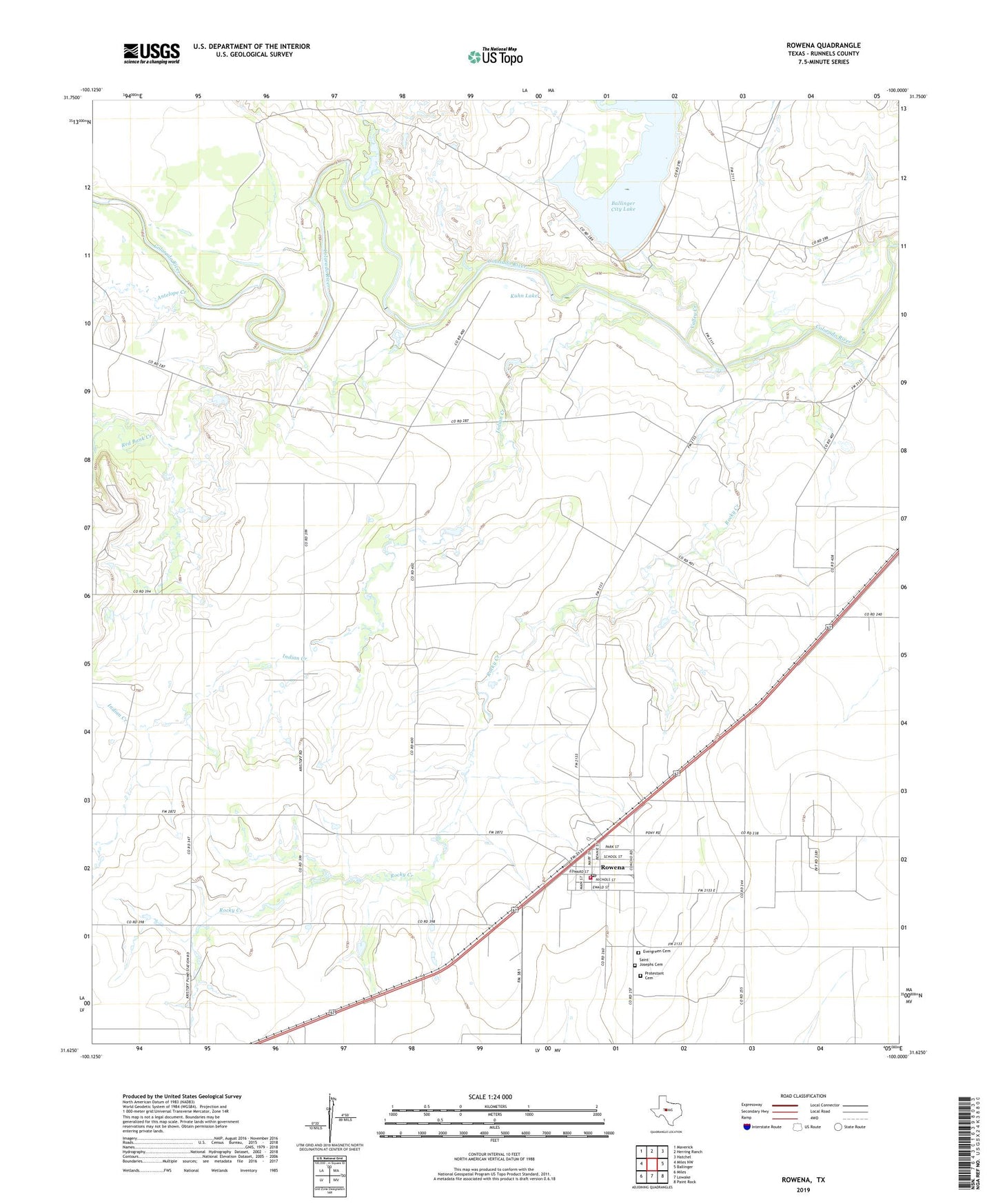
2022 topographic map quadrangle Rowena in the state of Texas. Scale: 1:24000. Based on the newly updated USGS 7.5' US Topo map series, this map is in the following counties: Runnels. The map contains contour data, water features, and other items you are used to seeing on USGS maps, but also has updated roads and other features. This is the next generation of topographic maps. Printed on high-quality waterproof paper with UV fade-resistant inks.
Quads adjacent to this one:
West: Miles NW
Northwest: Maverick
North: Herring Ranch
Northeast: Hatchel
East: Ballinger
Southeast: Paint Rock
South: Lowake
Southwest: Miles
This map covers the same area as the classic USGS quad with code o31100f1.
Contains the following named places: Antelope Creek, Ballinger City Lake, Crossroads School, Evergreen Cemetery, Indian Creek, Kristoff School, Kuhn Lake, Kuhn Lake Dam, Quarry Creek, Red Bank Creek, Rocky Creek, Rowena, Rowena Census Designated Place, Rowena Oil Field, Rowena Post Office, Rowena Protestant Cemetery, Rowena Volunteer Fire Department, Saint Josephs Cemetery, Valley Creek